EV Drivers Are Getting Better Google Maps Route Planning - With A Catch
Google is adding new features for electric vehicle drivers to Google Maps, improving its algorithms for EV route planning, though just who'll be able to make the most of them will depend on what's parked in your garage. The goal, Google says, is to improve how trip planning for journeys that involve two or more recharging pitstops is handled, to reduce stress and trim driving time.
The new routing algorithms rely on what's known as graph theory, effectively calculating multiple routes through different charging locations so as to pick the most efficient. That's not just a matter of distance: factors like speed, altitude changes, weather, traffic, and other trip metrics have a significant impact on how far an EV can actually go on a charge. Meanwhile, the speed of individual chargers also needs to be taken into account.
Google says that it can combine all of those factors for the best route in under 10 seconds. "You can see how long each charge will take and your updated total trip time," Alex Donaldson, Product Manager for Google Maps explains, "so your final ETA will never again be a mystery."

It's not the first addition to Google Maps with EVs in mind. Google previously updated its listings for charging locations with extra details about just what sort of connectors you might find at each charger, so that drivers could better match their car's capabilities to the plugs on offer. It then added real-time status to the maps, so that drivers would know not only whether a compatible plug was there, but if it was currently in use with another vehicle.
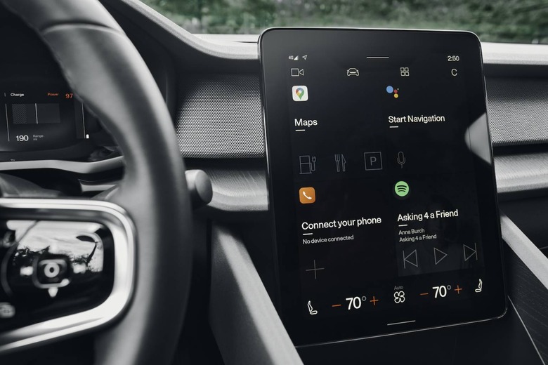
The difference between that and Google's new features announced today, of course, is just who can access them. The real-time charger location and status information is available to anybody with Google Maps on their phone or in the browser, whereas the updated routing algorithms launching today require having a vehicle that's running Android Automotive OS. That's Google's platform for vehicles – not to be confused with Android Auto, which involves projecting your smartphone display on top of the car's underlying infotainment system – which so far is only available on a couple of models.

Right now, indeed, you'll need to be driving either a new Polestar 2 or a new Volvo XC40 Recharge in order to have Android Automotive OS on your dashboard. Volvo is set to launch more models with the platform, along with other automakers like GM, but it's worth noting that the timescales of car companies are typically a lot more protracted than that of consumer tech firms.

Other additions to the version of Google Maps built into car dashboards are more information on charging locations. That includes which are the fastest, and which are compatible with any specific charging company membership you might have. "You can also see if a charging spot is close to a grocery store or coffee shop," Donaldson says, "so you can knock out errands or recharge yourself with a latte while you wait."
In Europe, Google Maps will also begin showing what payment methods are supported at different stations. That's launching initially in twelve countries – Belgium, Germany, Spain, France, Italy, Netherlands, Sweden, Austria, Switzerland, Denmark, Finland, and Luxembourg – with more promised in the pipeline.