5 Of The Oldest UK Roads Still In Operation Today
The long and winding history of roads goes back millennia, and it's argued that the Roman Empire did it best. People focus on the Roman Empire's vastness, its organization, and its military operations, but the infrastructure it built out remained long after all the rest of it disappeared. One of many places with evidence of that is, perhaps surprisingly for some, the U.K. England was under partial Roman occupation for roughly 400 years, and when the Romans left, they left their roads behind. Some are still functional — even if it's only the original location, not the literal, same road Roman builders made — and you can drive, bike, or walk on them yourself. These things are old, far older than even the oldest American roads that still in use.
We want to be clear here, this is not an exhaustive list of the absolute oldest roads in the United Kingdom. For that, we'd need a book. Further, not all ancient U.K. roads are Roman — some vastly predate that occupation. The "in operation" moniker presumes that some part of each example can be driven on, though as you'll see, many of the U.K.'s older roads are sprawling, rambling things that might have some unpaved segments too. But that's the fun after all, isn't it? Seeing how humanity's haphazard development over the years has incorporated the infrastructure that came before, even if people didn't realize it. These five roads in the U.K. are a small handful of examples ancient human ingenuity.
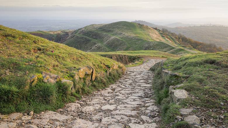
The Ridgeway
The Ridgeway is called Britain's oldest road by some, having seen use for at least 5,000 years by traders, medieval armies, and cattle drovers taking their herds to market. In its entirety, the diagonal stretch is 85 miles long, or 137 kilometers, going southwest to northeast from Overton Hill to Ivinghoe Beacon. The historic path takes you past even more history, like Neolithic stone circles, old castle grounds, hill forts (like the famous Segsbury Camp), deserted villages, and the iconic Uffington White Horse, a chalk image over 3,000 years old that's similar to others like the Cerne Abbas Giant. Of course, it's not uncommon in the U.K. to find yourself steeped in centuries of history, but the Ridgeway provides a clear-cut path through it.
Today, the Ridgeway is dedicated mostly to rural use and trail hikers. However, you can drive paved sections of it, or at least follow near the line of the original trail. Those willing with a trail-rated Jeep can try more of a path through bucolic fields on the Ridgeway's country road segments. Some people have taken it almost like a pilgrimage, using it as an excuse to soak in the landscapes between its two points.
It's a great all year-round trip to take, and you'd be hard pressed to get lost. At most, you might need some waterproof gear and footwear if you're going to be trekking the wetter parts during wetter times — also considering rainy Britain. You'll also want food for those longer rural sections. For those looking to get away from tourists, Ridgeway is an excellent choice.
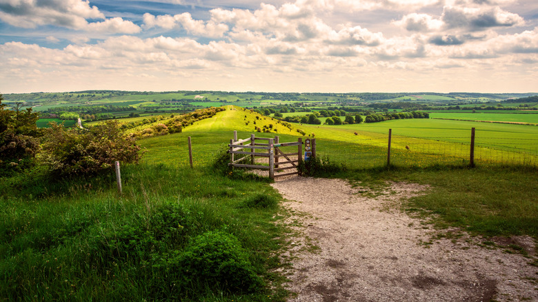
Icknield Way
Icknield Way is also called Britain's oldest road. You can see a running theme here. There's some dispute over just how old some of these roads are. In fact, some experts believe Icknield Way isn't ancient at all. In any case, Icknield Way is longer than Ridgeway. It's 110 miles (or 177 kilometers) tracing another squiggling, diagonal line north from Thetford down south to Ivinghoe Beacon — yes, that Ivinghoe Beacon that inaugurates Ridgeway. Icknield Way starts where the Ridgeway ends. It was once theorized that the Ridgeway and Icknield Way comprised some long, prehistoric highway, but such a notion is also in doubt.
Ridgeway and Icknield Way share the same DNA: a patchwork of drivable country roads, dusty foot paths, and hiking trails that carve their way through quaint British countryside and countless historical sites. You can thank the Icknield Way Association for maintaining the route and ensuring it stays true to its origins. YouTube EastAnglianBushcraft did the whole thing in four days, to give you an idea of what you can expect if you want to try the whole thing. Same as the Ridgeway, though, Icknield lends itself to day travelers who want a brief, nice scenic walk along one part.
British YouTuber Tom Scott made an excellent video on Icknield Way. In it, Scott talks about how Icknield (and many others like it) only exist thanks to community efforts and stringent legislation. It was nearly lost to private land ownership that would have forbidden free public use, and it took a considerable deal of effort to preserve it. At the time the video was made, that was still an ongoing process. It's proof that we can't take these historical sites for granted, we have to work to protect them.
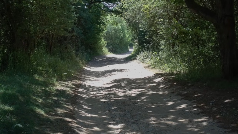
Fosse Way
Icknield Way and the Ridgeway seem to predate the Romans, but Fosse Way is Roman to the core. Where others let the topography dictate wends, Fosse Way cuts straight through, going from Exeter to Lincoln, approximately 230 miles in total. According to British Heritage, the Fosse Way grew in tandem with Rome's northward invasive expansion into what is now modern-day England. If you know Latin, "fosse" means "ditch." It's unclear if Fosse Way was originally a road that included a ditch, or was a ditch converted into a road. Regardless, you'll get Roman history along it. The entire length passes by the sites of Roman forts, bathhouses (there's a reason Bath got its name), walls, and much more.
This is not an uninterrupted road you can drive (or walk) from one end to the other. It's bits and pieces comprising modern parts of the A429 and B4455, as some examples, and more off-the-beaten paths perfect for walking or riding. Mountain bikers will also enjoy the unpaved sections. It is longer than the Icknield and Ridgeway combined. Don't visit Fosse Way if you're imagining a stroll along cobbled roads, passing by leftovers of stone walls and bridges that have stood the test of time, because those are rarely seen. You'll need a history book and a keen eye to spot the indications of past Roman civilization. Perhaps it would be an excellent chance for archaeologists to use LIDAR to discover more. We recommend researching Roman archaeological sites and museums nearby the Fosse Way, such as the Chedworth Roman Villa.
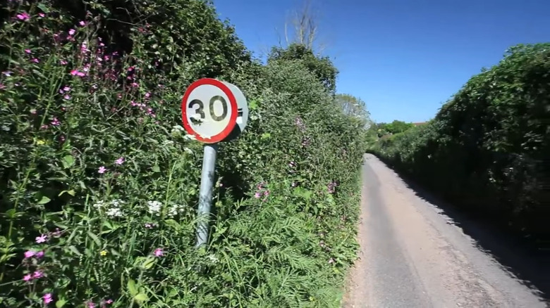
Watling Street
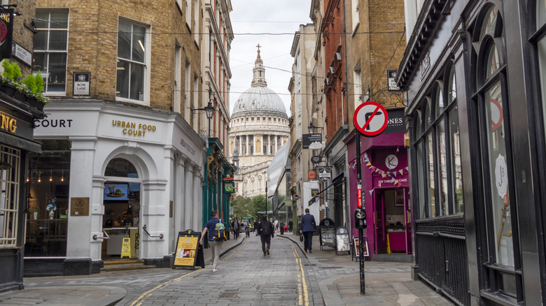
Watling Street might look like any other street in London, but don't let the name fool you. Once, Watling Street went almost to the Welsh border in Wroxeter, covering 276 miles. Once again, it's not an uninterrupted length, but sections of it will pop up. In 2024, a construction project uncovered a portion of it under an existing road in Southwark. Some claim that even though the evidence isn't immediately obvious, features of the land indicate where the rest of the original road likely is in London. Historically, it appears that Watling Street was around before the Romans invaded and later was incorporated into their road system — likely part of a longer route.
Of course, you can walk the London route no problem, though it's pretty short and would only take you a couple of minutes at most. Look at it yourself on Google Maps, and you'll find a pretty standard London street. Other parts of it will take you all over. The A2 and A5 road, according to Roman Britain, are close to or on Watling's original course and used still today. You'll once more find plenty of country roads, some of which cross by old bits of Roman history, like a possible sandstone bridge in Shropshire.
Another fun fact about Watling Street is the so-named Battle of Watling Street between Roman Gaius Suetonius Paulinus and the rebel queen Boudicca of Iceni in 61 AD. HistoryMarche on YouTube provides a dramatic retelling and visualization of the bloody battle. Boudicca lost but refused to surrender, dying by suicide. Although it's been dubbed the Battle of Watling Street, its exact location is unknown.
Ermine Street
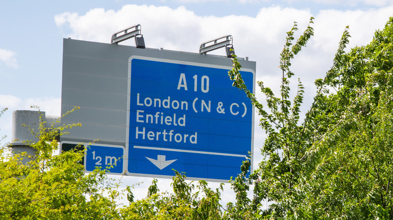
The first thing to know about Ermine Street is it has nothing to do with the animal, but rather is derived from the Earningus tribe, according to Roman Britain. Similar to Fosse Way, this one was built fairly early on in Rome's invasion from Bishopgate to Brough, circa 43 CE, and became the way you'd take back then if you wanted to get to Hadrian's Wall. You've probably heard of it before, that's the island-spanning wall in northern England that loosely inspired George R.R. Martin's "Wall" in "A Song of Ice and Fire." Today, you'll drive down (parts of) Ermine Street when you take the A10 and A1.
You know the drill. Ermine Street is broken up in pieces, and would be too long of a journey even for dedicated hikers, but you can walk and/or drive large swaths of it near or around existing roads. Depending on which section you decide to take, you'll pass by occasional Roman ruins, such as burial mounds or excavated road sections, in addition to museums. Less obvious remainders are still there for those who pay attention, like banks and ditches. Of course, the real treat is enjoying the historic English countryside and the many churches and monuments you'll find along the way.