The 5 Best iPhone Apps For Hiking And Backpacking

Modern hiking and backpacking apps are more than mere navigational aids, they are comprehensive guides that seamlessly integrate with the great outdoors. Whether you're a seasoned trekker or a novice explorer, these apps offer a suite of features designed to cater to a range of needs. These apps encapsulate the essence of convenience and functionality; from ensuring you're on the right trail, to identifying mountains and offering real-time weather updates.
Beyond their practicality, these apps offer a mindset attuned to safety and preparedness. With a few taps on your iPhone, you can pinpoint your exact location, access trail details, and even identify distant mountain peaks. They equip you with knowledge about the terrain, enable you to stay updated on weather conditions, and even offer first aid tips at your fingertips.
In a world where unpredictability is part of the adventure, having these resources readily available can make your journey easier.
AllTrails
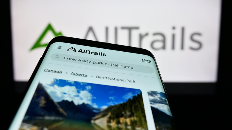
The AllTrails app has established itself as a solid companion for hiking and backpacking enthusiasts on iPhones. One of the standout features of AllTrails is its versatility. Whether you're hiking through picturesque landscapes of Colorado, or exploring the rugged trails of Vancouver, AllTrails provides valuable navigation and inspiration for your outdoor pursuits. It doesn't limit itself to just hiking; it supports various activities, making it an all-in-one solution for outdoor enthusiasts.
The app's pricing structure is reasonable, with a free version offering basic trail information and a paid AllTrails+ subscription priced at $35.99 per year. This subscription includes invaluable features such as offline maps, off-route alerts, and real-time weather updates. These features enhance safety and navigation, especially in remote areas without cell service.
AllTrails simplifies trail selection with user-friendly maps and filtering options. You can easily find trails based on difficulty, duration, type, views, ratings, and more. Users can save their favorite trails and even create custom maps, tailoring their outdoor experience to their preferences.
Integration with devices like Garmin Connect and Apple Watch adds another layer of convenience for tech-savvy adventurers. It optimizes GPS navigation, ensuring you stay on course even when offline.
Gaia

Gaia GPS offers a variety of membership options, including a basic version with unlimited map downloads, which is perfect for casual hikers. However, it truly shines with its Premium Membership, priced at $59.90/year (but often available with a discount), making it an attractive option for those seeking advanced mapping capabilities and offline access.
One of Gaia GPS' features is its offline functionality. Users can download maps beforehand, ensuring they stay on track even in remote locations, thus enhancing safety and navigation. Gaia GPS is a lifesaver for backpackers who rely on their iPhones for navigation. It's optimized for minimal battery consumption, allowing users to enjoy more than 3-5 days of GPS use on iPhones. This feature, coupled with tips for battery optimization, makes it a top choice for extended backpacking trips where access to power sources is limited.
The app offers an extensive library of maps, including freely licensed national maps. This diversity ensures that users can find the maps they need, whether they're hiking in the United States or abroad.
Gaia GPS prides itself on providing a clean and intuitive user interface, making route planning and tracking a breeze. Users can easily customize routes, track mileage, access real-time tracking, and edit maps. The app's unique features, such as National Geographic maps and cell coverage maps, further enhance its utility.
Avenza Maps

Avenza Maps is known for its offline mapping capabilities. This feature is a game-changer for hikers and backpackers who often venture into areas with limited or no cell service. With Avenza Maps, users can download maps ahead of time, ensuring that they have access to navigation information even in remote locations. This offline functionality enhances safety and confidence in the wilderness.
Another standout feature of Avenza Maps is its support for custom map imports. Users can bring their own maps into the app, allowing for a highly personalized and tailored hiking experience. This feature is particularly useful for those who prefer specific maps or have access to specialized geographic data.
Avenza Maps also offers a Map Store where users can access a wide range of maps from reputable sources like National Geographic and also offers a range of subscription plans to cater to different user needs. There's a free version that includes basic features such as map viewing, GPS tracking, and placemaking.
The Plus subscription, priced at $34.99/year, is perfect for enthusiasts, providing access to specialized travel, camping, and hiking maps. The Pro subscription, priced at $169.99/year, is designed for commercial, academic, or professional use, adding advanced features like shapefile import/export and priority technical support. There's also an Enterprise option tailored for organizations.
Although some users mention issues with manual map switching and occasional outdated river data, the overall consensus is positive regarding its reliability for outdoor navigation.
National Park Service

The National Park Service App provides extensive details about U.S. national parks, offering users a deep understanding of the natural wonders and historical significance of protected areas. It excels in delivering updates about park conditions, attractions, and historical information. For hiking and backpacking enthusiasts, having access to such comprehensive information about the parks they're exploring is very useful.
The app is designed with user-friendly navigation in mind. It simplifies the process of planning trips and navigating through the vast landscapes of national parks. This is particularly beneficial for hikers and backpackers who want to make the most of their time in these wilderness areas.
One reason for the app's popularity is its ability to make campground and lodge reservations. This is a huge advantage for outdoor enthusiasts, ensuring that they can secure accommodations in advance, especially during peak hiking and camping seasons. It also offers self-guided tours, which can be a real boon for those who prefer to explore independently, providing valuable insights into the park's history, ecology, and geology, enriching the hiking and backpacking experience.
National Park Service app is a free resource, making it accessible to all who wish to explore America's National Parks.
PeakFinder

The PeakFinder App stands out as an exceptional tool for hiking and backpacking enthusiasts, providing unparalleled mountain recognition and navigation features. This iPhone app, designed to enhance outdoor adventures, has gained recognition for its unique capabilities that cater specifically to hikers and backpackers.
Unlike typical navigation apps, PeakFinder focuses on summit identification and panoramic mountain views, making it an indispensable companion for those exploring the great outdoors.
One of the most remarkable features of the PeakFinder App is its ability to offer offline panoramic mountain views with names of over 1 million peaks worldwide. This means that even in areas with limited or no network coverage, hikers can still enjoy accurate peak identification and orientation.
The app utilizes GPS-based current location views, allowing users to align their camera overlay with the mountains they see, enhancing their understanding of the terrain. The touch interaction feature provides users with detailed information about the mountains, while the telescope function aids in identifying less prominent peaks.
PeakFinder offers advanced tools for vertical exploration, too. It provides arrows and sliders that allow users to adjust compass settings, visibility, and even celestial configurations. This depth of customization enhances the user experience and provides essential information for navigating challenging terrains.
In terms of pricing, the app costs $4.99, and considering its unique and specialized features, users may find the investment worthwhile.