6 Of The Highest Reviewed Mobile GPS Devices For Your Next Camping Adventure

We may receive a commission on purchases made from links.
If you're an avid camper, you understand the limitations of relying solely on paper maps and a keen sense of direction. Navigating the wilderness requires a tool (apart from the map apps for Android and iOS) that not only charts your course but also opens up other possibilities for exploration and discovery. While you have the option to use your phone as a tracking device, it is not always recommended. This is where mobile GPS devices come in, changing the way we traverse the great outdoors and ensuring you can find your way back to civilization after an immersive camping experience.
A good GPS device can offer far more than just directional guidance – it provides a digital gateway to detailed maps, real-time tracking, and a plethora of features tailored to the unique challenges of camping and hiking. However, not all GPS devices are created equal. Some are more suitable for camping than others, depending on their features, battery life, durability, and accuracy.
To help you choose the best GPS device for your next camping adventure, we have compiled a list of 6 of the highest-reviewed mobile GPS devices on the market. These devices have received positive feedback from customers and experts alike, and they offer a range of functions and benefits that can enhance your camping experience.
Once you make your choice, keep in mind not to take any GPS/messenger device straight into the wild without testing it in an area with connectivity first — send and receive a few satellite messages to ensure it's working before relying on it in the backcountry.
Garmin GPSMAP 67i
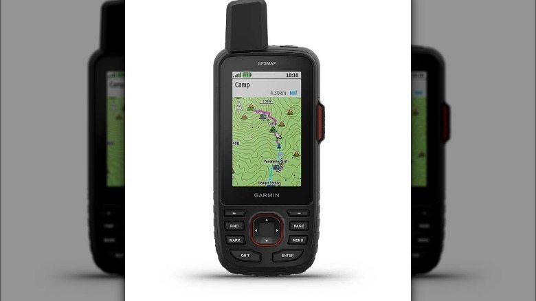
Garmin GPSMAP 67i is the best overall GPS device that combines navigation, communication, and smart features. It has a multi-GNSS system that tracks your location using GPS, Galileo, and QZSS satellites, providing reliable and accurate positioning in remote areas. It also has a large 3-inch color display that is easy to read and use.
The device comes with preloaded topo maps that cover the US and Canada, but you can also download additional maps from Garmin Explore or use a microSD card to load your own maps. As per a 67i user on Reddit, this mobile GPS device has the capability to display even the tiniest trails that may not be readily apparent on official maps. One of the main advantages of the GPSMAP 67i is its inReach technology, which allows you to communicate with anyone, anywhere, using the Iridium satellite network. You can send and receive text messages, share your location, track your progress, and request help in case of emergency.
However, to use the inReach features, you need to subscribe to a monthly or annual plan, which can vary in cost depending on your usage. You can also connect it to your phone via Bluetooth or Wi-Fi to access more features, such as weather forecasts, smart notifications, and wireless syncing.
The only downside is that this device is quite pricey, costing $600 on the Garmin website and Amazon, and the inReach subscription adds to the cost.
Garmin inReach Mini 2
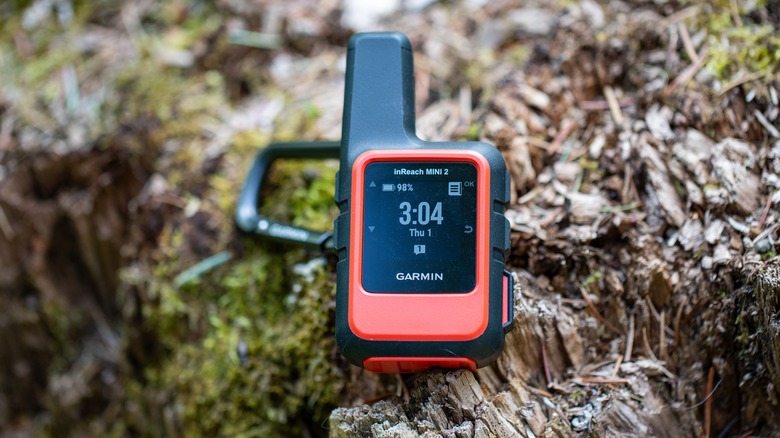
If you're on the lookout for a compact device that's easy to carry and does the job of tracking, sharing your location, and providing emergency communication, the Garmin inReach Mini 2 is a good option.
It has a small 0.9-inch display that shows basic information such as battery level, signal strength, and messages. This device uses the Iridium satellite network to communicate with anyone, anywhere, but you will need an active satellite subscription for that.
One standout function as per the users is the TracBack routing feature that allows you to navigate back to the starting point of your activity along the path you traveled. This can be helpful when finding your way back from where you started. To use the TracBack feature, you need to record your activity and then select the TracBack option from the menu. The device will display your route with a magenta line, start point, and end point. You can navigate using the map or the compass
As for battery life, it hinges on the mode in use. The default mode, with a 10-minute tracking send interval and standard activity recording, boasts up to 14 days with a full sky view or around 4 days amid moderate tree cover. It is available for around $400 on Amazon.
Garmin eTrex SE
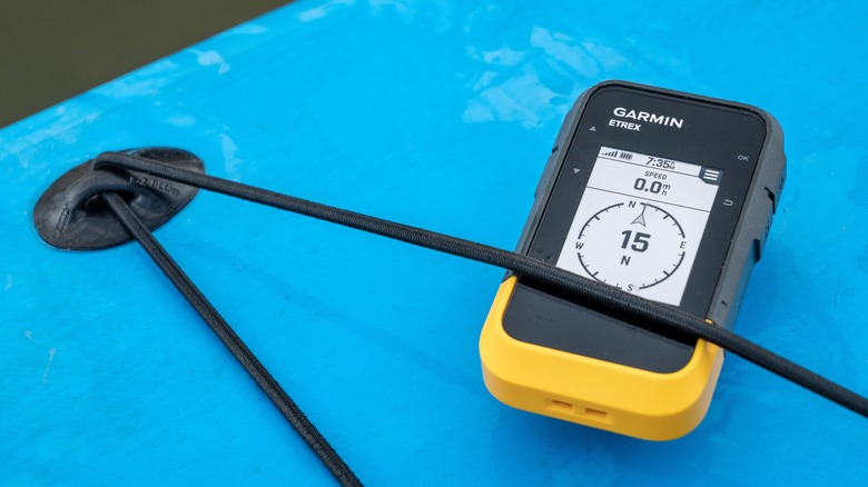
Not everyone is keen on shelling out big bucks for a GPS. Garmin eTrex SE is recommended by camping enthusiasts for those who want a basic and budget-friendly GPS for activities like hiking or geocaching. It keeps it straightforward and reliable for tracking your location, altitude, speed, and distance.
While you won't find fancy features like a color screen or touchscreen, the 2.2-inch monochrome display gets the job done, especially in harsh sunlight. You will find two buttons on each side which make navigation easy, even though it skips the joystick found in some other eTrex models. Plus, it packs a digital compass for accurate headings, even when stationary. The battery can last for up to 168 hours in standard mode and up to 1,800 hours in expedition mode if you use 2 field-replaceable AA batteries.
To make the best use of it, pair it with the Garmin Explore app on your phone. This will allow you to access additional features like cloud storage, real-time forecast information, trip planning, smart notifications, and additional mapping. You can get it for $150 from the official website or Amazon.
Garmin eTrex 32x
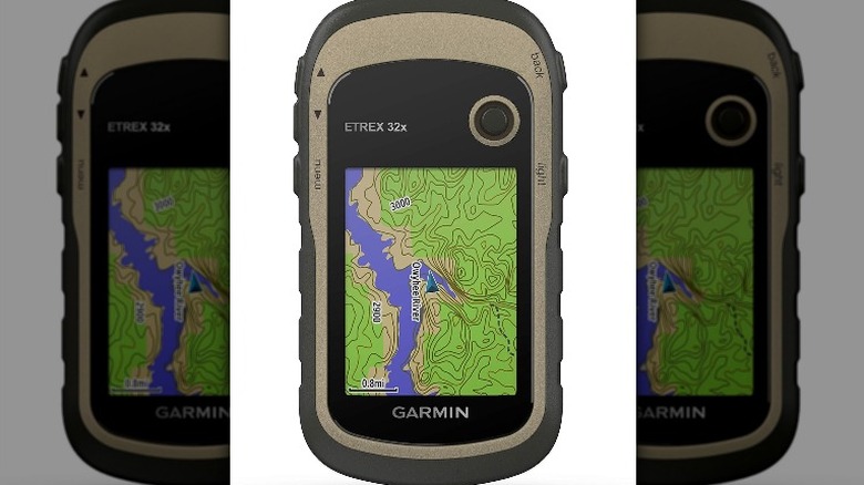
The Garmin eTrex 32x is another decent option ideal for adventurers who need a device that can do it all. It comes with a 2.2" color display, GPS and GLONASS satellite system support, a 3-axis compass, 8 GB of internal memory with a microSD card slot, and a barometric altimeter, among other features.
It also features preloaded topo maps for outdoor activities that feature both trails and streets. The maps will show you interesting points around, such as restaurants, universities, accommodations, etc. You will also find detailed hydrographic features like coastlines, wetlands, and seasonal streams on the maps. If you are traveling on a bicycle or an ATV, you can make use of the auto-mount capability and City Navigator NT maps for driving directions.
The battery life is quite impressive -– up to 25 hours in GPS mode with 2 AA batteries. This device also supports paperless geocaching, allowing you to upload GPX files on your device to view the key information easily. Expert reviews also mention that the Garmin eTrex 32x has an intuitive and user-friendly interface, making it a good choice for first-time GPS device users.
You can find it on Amazon for around $250-300.
Coros Vertix 2
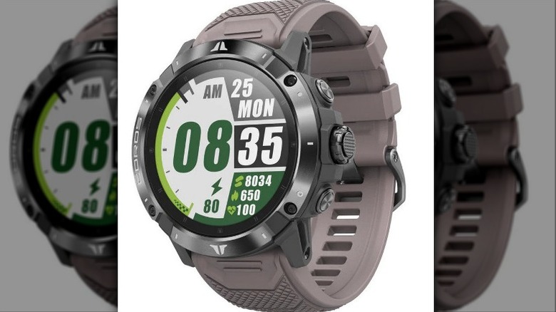
If you prefer wearables on adventures or want your GPS device to also play the role of a fitness device, the Coros Vertix 2 might interest you. The VERTIX 2 has a built-in global offline mapping feature that allows you to navigate with ease in any terrain.
This watch offers three modes to choose from; Landscape, Topo, and Hybrid mode. Once you have selected a mode, you can download your preferred Topo map by region for free from the COROS website. These maps are easy to navigate, as you can also zoom in and out of the map with the digital-dial, or drag around the map with the 1.4-inch touch screen.
It also has the ability to communicate with all five major satellite systems (GPS, GLONASS, Galileo, QZSS, and Beidou) at the same time.
One of the most notable features according to the users and experts is the battery time, which is up to 140 hours in standard full GPS mode, or 60 days in normal use. It is made to withstand extreme temperatures and is even water resistant up to 100 meters so you can take it anywhere with you.
It also has additional features that can measure your heart rate, heart rate variability, blood oxygen level, sleep quality, and more. Beyond its GPS functionalities, the Vertix 2 monitors health metrics such as heart rate, heart rate variability, blood oxygen, and sleep quality. Additionally, it offers practical features like playing music, controlling your Insta360 action cam, and receiving smartphone notifications.
You can find it on Amazon for $700.
Garmin Montana 750i
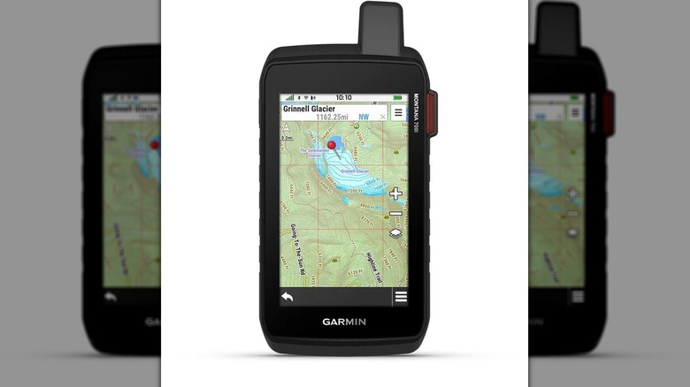
If you're looking for a GPS device with a smartphone feel, the Garmin Montana 750i is worth considering. It sports a 5-inch color touchscreen display, an 8-megapixel autofocus camera, a 3-axis compass, a barometric altimeter, and an accelerometer that provides accurate information.
The touch screen is glove-friendly and can adjust sensitivity. The built-in 8 MP autofocus camera can take photos and videos, and automatically geotag them with the location where they were taken. You can connect it to your smartphone using Wi-Fi and share your adventures, photos, and geocaches with friends. You'll also get notifications for calls, texts, emails, and social media alerts.
It has a preloaded TopoActive map that covers the US and Canada with routable roads and trails as well as displays public land boundaries to keep you safe. You can also upload additional maps from the Garmin website. If you like to explore, the device comes with a preloaded app that can help you download trails shared by others. The only downside, according to users is that you might need to spend some time getting to know the device, as it does not come with a detailed user manual. You can find it on Amazon for $800.