All The Most Popular Map Apps For Android Ranked Worst To Best

In today's digital era, map apps have revolutionized how we navigate our surroundings. Gone are the days of relying on printed directions or designated navigators; now, our smartphones serve as our personal navigation assistants. Getting around is as easy as punching in an address on your smartphone, and Android users are spoiled for choice. There are dozens of different map apps on the Play Store, even some great Google Maps alternatives.
Finding a reliable map app for your Android device is key to smooth navigation. Each one has its own strengths and weaknesses. From offline capabilities to real-time traffic updates and advanced features, we've ranked the most popular map apps, ensuring you can discover the perfect fit for your needs.
We'll look at the unique features of each to see what makes these apps stand out in the sea of similar tech, as well as the benefits and drawbacks of each. Here are the most popular apps for Android ranked from worst to best.
CoPilot
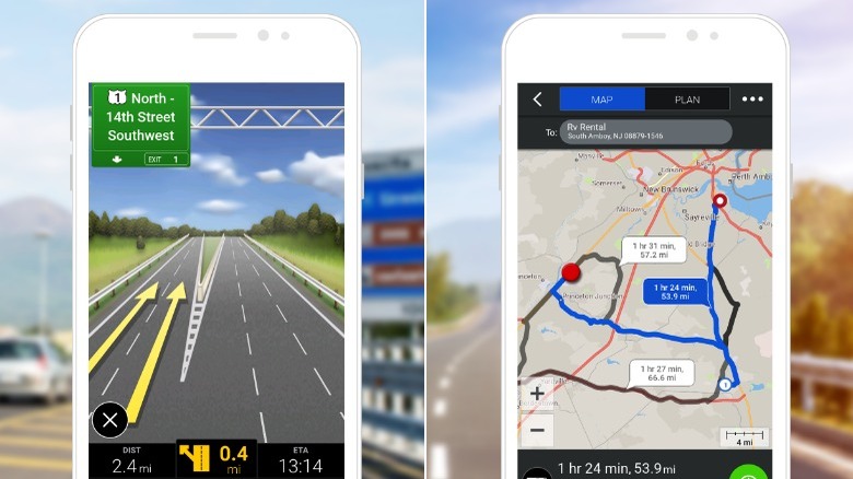
When it comes to navigation apps, convenience and ease of use are key factors. Unfortunately, CoPilot GPS Navigation might be a rocky journey for users seeking a convenient and straightforward navigation app. While CoPilot has nice graphics and proven popularity among Android users, its setup is an obstacle course.
Upon launching the app, users are immediately greeted with an unskippable signup page. Users are forced to sign up without the option for guest access, and email verification is not required. Next comes the big decision. Are you driving a car, semi-truck, or RV? Choosing the vehicle type and location come with restrictive warnings and additional purchases.
After enduring aggressive menus, long downloads, and nerve-wracking warnings, your CoPilot app is ready to navigate. With 15 minutes of setup, the CoPilot app is ready to go and before users can even type in their first destination, another pop-up appears. This one is to let you know that this is only a 14-day trial, and the app must be purchased for continued use.
It's worth noting that CoPilot GPS Navigation is a paid app with a high price tag. Considering the many other navigation apps out there, it's difficult to justify any investment in CoPilot. While it does offer offline maps, turn-by-turn directions, and voice guidance, there are other options that provide a smoother and more user-friendly experience without breaking the bank.
MapFactor
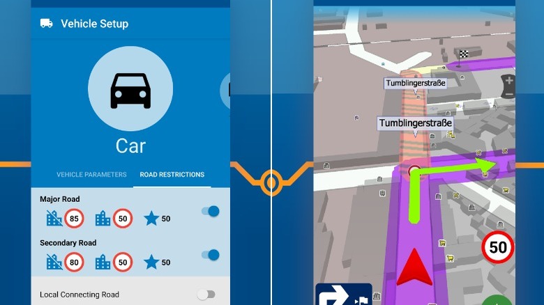
For anyone seeking a reliable navigation app, MapFactor Navigator offers a decent solution for getting around town. Powered by an open-source data set, users can download maps of whatever area they're in for offline use. This allows more trafficked areas to be updated quickly and more frequently. On the flip side, rural and less populous areas receive fewer updates.
If you need to navigate while driving, MapFactor is fully integrated with Android Auto. Free maps are available for download, but there is an option to purchase premium TomTom brand maps. These maps include street numbers and more detailed information. You'll be able to navigate to general areas without them, but for more specific map data, you'll need to download a paid map.
MapFactor isn't exactly loaded with features. The app offers a basic map experience with a number of excellent free offline maps. However, the absence of house numbers within these maps can be frustrating for precise navigation. While the option to purchase premium TomTom maps provides more detailed information, it's just hard to justify spending money on a map app when there are so many excellent free options available. If you like a minimalist approach and open-source maps, MapFactor will get you close to your destination, but not necessarily in the right driveway.
Polaris
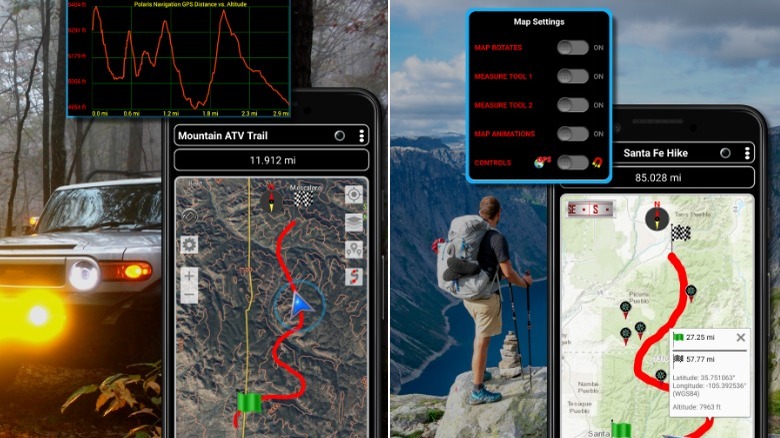
For adventurers, water sports enthusiasts, and outdoor aficionados, Polaris GPS is one of the best map apps to download, designed for those that love the outdoors.
While Polaris isn't your typical navigation app providing step-by-step directions on how to get to a specialty grocery store across town, its true strength is wilderness navigation. With its detailed topographic maps and compass features, it can help get you out of the woods.
Polaris is great for hikers and other trail riders. Users can mark trails on a map to show where they've been and map out new and exciting outdoor areas that they can explore. Users can also simply hit a record button and start hiking. The GPS tracker in the app will track the user data for hiking or trail riding.
However, Polaris isn't solely focused on land adventures. This app has several different nautical features for sailing and water enthusiasts too. Offering downloadable nautical charts and depth information, Polaris can also be a boating companion. Its drag anchor alarm feature further ensures water safety by alerting you if your boat has drifted beyond a safe distance.
Polaris isn't very useful for a commute, but if you enjoy the great outdoors, it is a great app to have. The only real downside is that it does play ads at random intervals. Upgrading to the premium version costs a one-time fee of $11.99 but removes ads and allows users to save even more trails and waypoints in the app.
Maps.Me
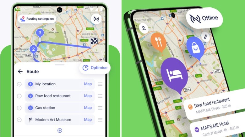
Maps.Me is a great app for those that like to take the road well-traveled or for those who like cute dog mascots. With its focus on social connectivity, this app aims to be your trusted companion and guide throughout all your adventures.
The social aspect of Maps.Me allows users to rate, review, and highlight nearby attractions. This makes the app particularly helpful for travelers or digital nomads. The app goes beyond simple navigation by offering information on tours, hiking trails, and various points of interest such as landmarks and museums.
The app is completely free of charge and users have the ability to download maps to access offline, making it an excellent choice while traveling abroad or to areas with limited network coverage. It even has a map of free Wi-Fi locations for users to connect to in case of emergency.
What sets Maps.Me apart from other navigation apps is its unique integrated wallet feature. Users can use Maps.Me as a payment source similar to Google Wallet or as a contactless payment method. While most banking services can be connected to platforms like Google Pay, Maps.Me's payments provide another layer of security in the event you lose your bank cards while traveling.
Moreover, users can enjoy a 10% discount when using the Maps.Me payment wallet on Booking.com. Although not essential, having a built-in wallet can be a valuable backup option in case of a lost bank card while on the road.
Sygic
Sygic is one of the most fun apps on this list. While it covers the basics of providing directions from point A to point B, it goes the extra mile with some unique additions.
One of Sygic's key features is its ability to transform your phone into a fully functional dashcam. By securely mounting your phone on the dashboard, you can activate the dashcam mode. This feature not only records your drive but also automatically saves the footage in case of emergencies or accidents.
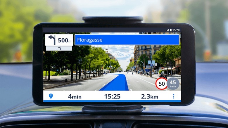
In addition to its practical functions, Sygic also offers some fun features. One is the futuristic heads-up display (HUD) that can be produced on your phone and car window. By activating HUD mode and placing your phone on the dashboard, you can view a clear, mirrored image that provides real-time data such as speed, directions, time, incline, cardinal direction, and driving duration — making a tedious drive a little more fun.
However, it's important to note that the exciting extras offered by Sygic come at a cost. While users can enjoy a six-day trial of these features, they are subsequently locked behind a paywall. Without a subscription, Sygic reverts to a generic navigation app. The premium version requires a subscription starting at $13.99 for three months or $19.99 for a year.
OsmAnd
When it comes to GPS navigation apps with the best offline capabilities, OsmAnd is a top contender. This app allows you to download maps and navigate through unfamiliar cities or countries without an internet connection, which can be immensely valuable while traveling.
Another handy feature for travelers is the point of interest (POI) overlay. OsmAnd can download Wiki data for nearby areas and pick up local attractions. The app then constructs a map overlay that allows you to identify nearby attractions and explore them at your own pace.
OsmAnd goes beyond just navigation and offers a social aspect tailored to outdoor enthusiasts. With specific options for trail running, hiking, jogging, horseback riding, skiing, and water sports, this app allows you to discover nearby outdoor trails for your next adventure.
While the OsmAnd app itself is free, there is a premium version available. The first option is Maps+, which provides access to additional data such as nautical depths, elevation maps, Android Auto integration, multiple map refreshes/downloads, and a Wiki integration for local attractions.
The second option is OsmAnd Pro, an all-in-one app that combines various app subscriptions, including everything offered by Maps+ along with additional features like weather data. Maps+ is priced at $5.00 per year, while OsmAnd Pro costs $2.99 per month.
AllTrails

AllTrails is a fantastic app for hikers and outdoors enthusiasts. Whatever outdoor activity you're interested in, AllTrails is your go-to resource for exploration. With its comprehensive filters and curated activities, you can find everything from mountain biking and trail running to camping and rock climbing.
AllTrails uses two types of data for its maps, Verified and OpenStreetMaps. Verified maps have the most up-to-date information available. These are represented by green lines on the map and have been verified by official sources. The other type, OpenStreetMaps comprise user-generated routes. This crowd-sourced data allows users to upload their own trails and hiking data, fostering a social aspect within AllTrails. It provides alternative routes and highlights hidden gems for fellow users to discover.
Beyond discovering new trails and routes, users can also contribute by ranking and reviewing them. This feature offers valuable insights and a realistic preview of what to expect on a particular trail. Whether a trail has fallen into disrepair or doesn't live up to its advertised features, you can read authentic reviews from users who have experienced it firsthand. This user-generated feedback is an excellent tool for conducting preliminary research before venturing out on a wilderness adventure.
HERE WeGo

Here WeGo is a solid navigation app that's kept up with the times, unlike its logo which may evoke memories of the 90s disposable cup graphic. Beyond the design, rest assured that the app itself is up-to-date and packed with useful features.
One standout feature of Here WeGo is its offline functionality, allowing users to save maps and data for use without an internet connection. This is particularly valuable for travelers who may find themselves in areas with limited connectivity. With offline maps, users can navigate unfamiliar territories without relying on a continuous internet connection. Furthermore, Here WeGo goes beyond basic navigation by providing information about local transportation options, including buses and trains, along with their respective schedules. This comprehensive approach ensures that users have access to a range of transportation methods, enhancing their travel experience.
A prominent aspect of the app is the emphasis on collections. Users have the freedom to curate collections of various locations based on their preferences and needs. These collections serve as a convenient way to organize and share locations with others. Whether it's planning an itinerary for a trip, compiling a list of must-see spots in your hometown, or creating a happy hour map for a pub crawl, Here WeGo simplifies the process of organizing locations into easily shareable collections.
Google Maps
Google Maps is the leader among map apps, and it's easy to see why. It comes pre-installed on most Android phones and it's been getting users to their destinations safely since 2005. Google Maps consistently updates its features and is backed by one of the largest internet companies in the world.
The sheer size of Google offers distinct advantages. It enables the company to introduce a ton of new Google Maps features and gather extensive data. Take Streetview, for example, which allows users to explore maps using 360-degree cameras. It didn't take long for users to make Google Streetview into a fun game.
The biggest downside to Google Maps is that it consumes a lot of data. Not cell phone data, but rather your personal data. With location services on, the app tracks and stores a lot of your geolocation data. By casually accepting user agreements, chances are, Google Maps has been logging your location since you first owned a smartphone. In fact, users can delve into their settings and review their history, discovering a detailed map of their daily whereabouts, stretching back years.
This feature can prove useful for retracing your steps or recalling specific locations from the past. But it's still rather unsettling to see the comprehensive record of your movements that's now in the hands of a corporation. While users have the option to opt out of data collection, most people just click "agree" without reading the fine print.
Waze

Waze is a feature-heavy navigation and map app that rivals Google Maps, even exceeding its abilities in several ways.
Waze will get you to your destination with a touch of style. Its user interface (UI) is clean and intuitive, ensuring users know exactly where to click. The app greets you with delightful and straightforward graphics, making it one of the easiest navigation apps to ... navigate. Additionally, Waze offers a range of vehicle options, including cars, motorcycles, and taxis, allowing users to plan accordingly.
Waze's custom navigation settings allow users to discover the ideal route every time. You can personalize your settings to incorporate specific filters that the mapping and navigation features will always adhere to. If you prefer to avoid tolls, Waze will steer you clear of them. Uncomfortable with busy intersections? Waze can help you bypass those as well. With an abundance of filters and adjustments available, Waze calculates a route that aligns with your personal comfort preferences. Additionally, Waze integrates with fast passes and HOV passes. By adding your toll pass to the app, it automatically determines which roads you can access.
What truly sets Waze apart from other navigation apps is its social aspect. Users have the power to report real-time road accidents or issues, alerting fellow drivers. With a simple click, you can inform other Waze users about accidents or the presence of traffic police. This interactive feature enhances community awareness and promotes a safer driving experience for everyone on the road.