How To Check Elevation On Google Maps
When you think of Google Maps, you often only associate it with how to get around new cities. However, it's filled with secret features that you probably did not know about. In fact, did you know that you can also use it to check the elevation of places you plan to visit?
At first, you may think that elevation isn't that useful to know. But for certain kinds of travellers, knowing how high the destination can make all the difference. Elevation can help determine a variety of information, especially related to temperature. Knowing how high a location is can mean the difference between a casual jacket and a full coat.
For athletes, knowing elevation is also a great tool for planning routes for hikes, bike rides, or even jumps. Not to mention, anyone who has travelled to mountainous regions knows the pain of wearing ill-fitted shoes or assuming the distance is the same uphill on holiday.
So, if you're an adventurous traveller who needs to know how high your next destination is, here are two ways to do that.
Checking elevation in Maps on PC, Android, and iPhone
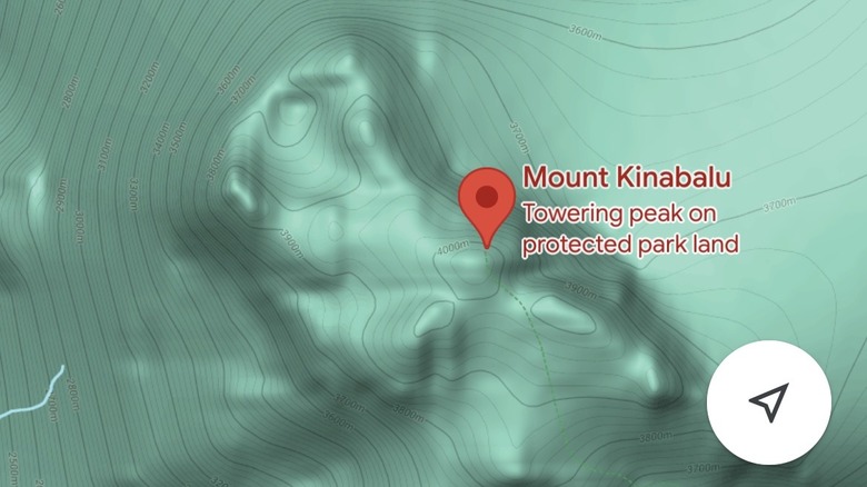
If you're knee-deep into planning for a trip on your computer, here's what you can do to know your elevation on Google Maps in a desktop browser. On the Google Maps website, in the upper-left corner, type in your destination in the search box. Once Google Maps drops a pin in your destination, click the layer button in the lower bottom half of the screen. From the choices provided, click Terrain. Afterward, the elevation will appear on the lines on the map.
Alternatively, if you're on the go and don't have access to your laptop or desktop, you can also check elevation in Google Maps on your Android or iPhone. Open the Maps app and search for your destination. Then, in the upper-right corner of the screen, press the layers icon. Lastly, select Terrain. Once you do this, you can zoom into the screen to view the elevation written on the lines.