Google Maps Vs TomTom: Which App Is Better For Android Auto
When you think of navigation, two names come to mind — Google Maps and TomTom. One is the most widely used navigation app in the United States, and the other is one of the most well-known sat nav brands of all time. Of course, now that we carry powerful computers around in our pockets, you might be more likely to use the TomTom GO app rather than a dedicated sat nav.
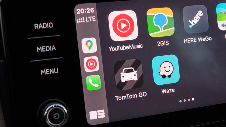
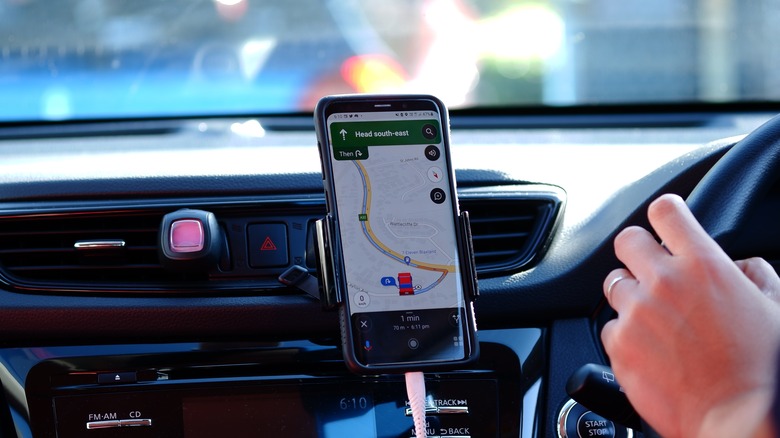
Both Google Maps and TomTom GO are compatible with Android Auto, the nifty tool that lets you display and interact with your phone apps on your car's dashboard display. But which app provides the superior navigation experience? Google Maps is bursting with useful location information and is free to use, but many drivers have been relying on TomTom for years and believe the paid app offers smoother and more focused navigation. In this article, we'll take a deep dive into how each app performs on the core features and what kinds of extras they provide.
What is Google Maps?
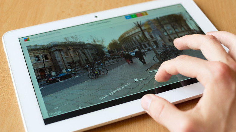
Google Maps was first launched as a desktop website in 2005 and has since grown to include famous features like Street View and Google My Business. It's been available on smartphones since 2007, with the now-familiar Android and iOS apps launching in 2008 and 2012 respectively. Although Google Maps can help you walk, cycle, bus, train, or ferry your way from point A to point B, what we're interested in today is car navigation.
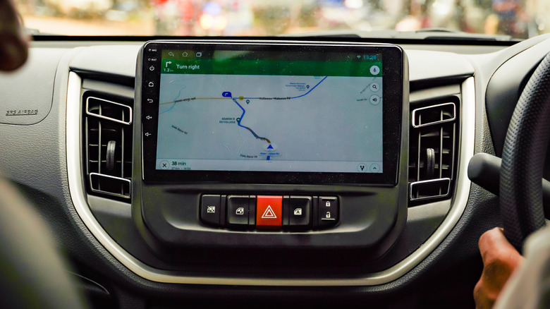
Once you have Android Auto set up on your vehicle dashboard, Google Maps is the default app it'll use for your navigational queries. When you say the magic words "Hey Google" and ask for directions to the nearest gas station, Google Maps is what will open on your screen. Thanks to its collection of over 200 million businesses and locations, it's easy to find where you want to go — and check if it's still open. There's also real-time traffic news and even offline map features to help you get around when you don't have a connection.
What is TomTom GO?
Launched for Android in 2015, the TomTom GO app brings the interface, traffic updates, and speed camera warnings of the TomTom GO sat nav model to mobile users. Like its other products, the app costs money in the form of a monthly or yearly subscription fee, though there is a week-long free trial available. The app literally uses the same interface as the sat nav so while it looks familiar to existing TomTom customers, it's a bit of an odd look for anyone expecting a more smartphone app-centric design.
Unlike Google Maps, the TomTom app is all about navigation. It will get you to the restaurant of your choice but don't expect it to show photos of the menu items. Instead, you can rely on it for real-time traffic updates, road closures, and extensive route planning options. Plus, with its Android Auto compatibility, you can display your routes right on the dashboard of your car and hear voice instructions through the sound system.
Route planning and customization
The fundamental goal of any navigation app is to get you from one place to another safely and efficiently. In Google Maps, when you type in or say your destination, you'll be given multiple routes to choose from — fast routes, fuel-efficient routes, and alternative routes. You can also choose to avoid tolls, motorways, or ferries in the options. You can also choose whether the app suggestions prioritize speed or fuel efficiency. Once your route is decided, you can add stops along the way, with shortcut buttons for finding gas stations, restaurants, coffee shops, and supermarkets. You can also set a time to depart or arrive and set a reminder for when it's time to leave — as well as share the directions with a friend.
TomTom offers a lot of similar features. You can set permanent preferences so the app always plans the fastest, shortest, most eco-friendly, or most winding route, as well as set it to ask you each time. There's also a broader set of avoid options — ferries, toll roads, carpool lanes, unpaved roads, motorways, tunnels, and country borders. When your route is set up, you can make adjustments like switching to an alternative, avoiding part of the route, adding a stop, or changing the route type. TomTom's range of shortcuts for finding and adding a stop include parking, charging parks, gas stations, restaurants, hotels, airports, and hospitals. If you add a stop and then change your mind, there's even a "skip next stop" option.
Voice navigation and voice commands

Both apps offer a range of voices and languages so your app can read aloud instructions and place names however suits you best. Google offers 14 language options, five of these being different regional versions of English. TomTom, on the other hand, has around 44 different language options with a range of recorded voices and computer voices available in each.
There are also voice commands that allow you to set a route and make changes without taking your hand off the wheel. This is easy to use with Google Maps since both Android Auto and Google Maps use Google Assistant, and the default navigation app for Google Assistant is Google Maps. You can tap the microphone button on the screen, say "Hey Google," or, in certain cars, use the dedicated steering wheel button to activate voice commands.
Using voice commands with a third-party app like TomTom, however, is more complicated. Third-party apps can integrate some Google Assistant voice command features but options are limited, with Conversational Actions being sunsetted in June 2023. Although TomTom Go doesn't seem to support voice commands, the free and community-run app TomTom AmiGO does.
Using maps without an internet connection

Downloading maps for offline use is a crucial navigation feature for people who travel off the beaten path or just want to prepare for any signal outages. With a downloaded map, you can continue to check out where you are and receive turn-by-turn instructions even when you don't have an internet connection. Both Google Maps and TomTom offer this feature but they go about it in different ways.
Google Maps lets you download sections of a map by zooming in and out to capture what you need. As you adjust the selection window, the app tells you how much space the map will take up when you download it. Once it's all done, you'll be able to search and get directions within that area.
TomTom GO approaches offline maps by having users choose a country map to download as soon as they open the app for the first time. It will suggest the country it thinks you're in but you can select whichever country you want. This is a mandatory step to accessing the app in general, and the map can take a significant amount of time to download depending on the strength of your internet connection so it's best to plan ahead.
Google Maps features that TomTom GO doesn't have
Google Maps can do a lot of different things, from showing the street view of the location you're looking at to giving real-time information on how busy an area or business is. Of course, you can also use it to plan routes when you're walking, cycling, or using public transport so if you'd prefer to learn the ins and outs of only one app, you can rely on Google Maps for pretty much anything.
As previously mentioned, Google Maps is also famous for its business profiles, where you can get links to a business's website, see photos of the interior or products, view the opening hours, and even check reviews. There's also a fairly new feature called Live View that helps people navigate on foot using augmented reality, with arrows popping up exactly where you need to turn. If you're into voice commands, Google is also the way to go. Third-party app compatibility is patchy at best, and it's just a lot easier when you let Google Assistant use its default Google apps.
TomTom GO features that Google Maps doesn't have
Despite its more narrow feature set, TomTom GO does still have a few perks that Google Maps is lacking. To help the app find the best, fastest, and most eco-friendly routes, users can provide a variety of information about their specific vehicle. This is especially useful for truck drivers, who can add their engine type, fuel type, truck dimensions, maximum speed, and cargo type.
The app also lets drivers know when speed cameras are coming up, so they can make sure they're within the exact speed range they need to be to avoid trouble. This is a handy feature for people who drive a lot and one that Google Maps doesn't have at all.
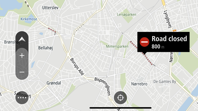
While both apps show real-time traffic updates, only TomTom GO shows road closures. If you live in an area where road closures are frequent, this is a helpful feature that can help you plan routes better and arrive at your destination faster.
All in all, the best choice for you depends on a variety of things. Do you prefer to do all of your cafe finding, train journey planning, and car navigation in one place? Then Google Maps might be for you. If you're a truck driver who can benefit from the app knowing your vehicle dimensions and alerting you to closed roads and speed cameras, maybe TomTom GO is the way forward — but don't forget you've got to pay a monthly fee to use it!