This Stunning 3D Melting Snowflake Could Boost Ice Storm Prediction
A NASA scientist has developed the first three-dimensional model of melting snowflakes, producing a video that's not only beautiful but could have serious implications for weather forecasting and understanding climate change. Not all snow is created equal, and scientists have been attempting to figure out how best to simulate its melting given the many factors that can affect that transition. This new model, detailed in a paper in the Journal of Geophysical Research, has worked it out.
It's the handiwork of Jussi Leinonen, one of the scientists at the NASA Jet Propulsion Laboratory in Pasadena, California. That may not be an area particularly known for its snowfall, but part of Leinonen's day job involves figuring out radar profiles of the atmosphere captured by the space agency's high-resolution instruments.
Those cross-sections, spanning from close to the planet's surface up to the upper atmosphere, still contain some mysteries. For instance, there's a prominent layer where falling snow and hail each melt. "The reasons for this layer are still not particularly clear," Leinonen explains, "and there has been a bit of debate in the community."
Of course, this isn't the first model of melting snowflakes, but it is one of the most in-depth so far. First, the concave regions of the surface of the snowflake serve to gather meltwater; that gradually grows in volume until each region merges. The resulting liquid husk around an ice core eventually develops into a water droplet.
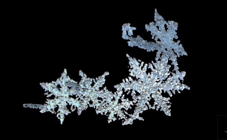
The video above shows the 3D rendering produced by Leinonen's mathematical model. In it, a snowflake roughly a centimeter in length is shown, consisting of multiple ice crystals that have become entangled.
While the animation may be beautiful, there's more than just aesthetics to recommend it. According to NASA, the model will have practical applications for weather forecasting, particularly in understanding how wetter, heavier snow shows up on radar. Differentiating that from lighter snowfalls could make a big difference when it comes to predicting areas at risk of power outages and blocked roads, where power lines and trees can be brought down by the extra weight.
Beyond that, though, the model could have broader implications for climate change in general. NASA is already monitoring the change of ice sheets, sea ice, and snow cover across the globe; applying mathematical understandings like this one to the changes in that ice and snow could assist in predicting the evolution of Earth's temperature. Later this year, two new satellite missions are scheduled to launch, better extending the research of the current state of global ice and snow.