This NASA Space Laser Has Climate Change In Its Sights
NASA's mission to measure the impact of climate change and other factors on melting polar ice caps is off to a good start, with ICESat-2 set to use lasers to track just how precarious the situation is. ICESat-2 – or the Ice, Cloud, and land Elevation Satellite-2 – will pick up where its predecessor left off, only with a much higher degree of accuracy.
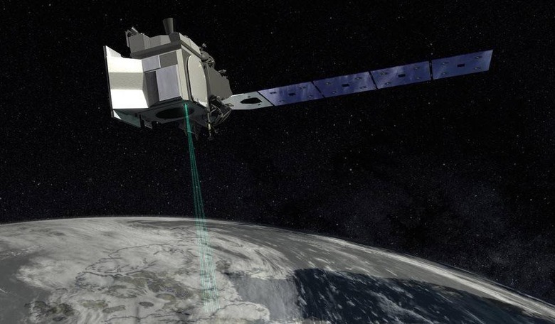
Unlike other recent NASA launches, which have seen multiple instruments taken into orbit, ICESat-2 carries but one instrument. The Advanced Topographic Laser Altimeter System, or ATLAS, uses green, visible laser light that pulses at a wavelength of 532 nm. That single laser will be split into six beams, organized into three pairs, and fire at 10,000 times per second.
By the time they hit the Earth's surface, each pair will be separated by a distance of just over two miles. As ICESat-2 moves in orbit, it will take a measurement of height at each point, roughly every 28 inches. With that, it will be able to estimate elevation at each point, thus allowing researchers to figure out the height differences between the sea ice and the polar oceans.

"With this mission we continue humankind's exploration of the remote polar regions of our planet and advance our understanding of how ongoing changes of Earth's ice cover at the poles and elsewhere will affect lives around the world, now and in the future," Thomas Zurbuchen, associate administrator of NASA's Science Mission Directorate, said of the launch.
The results will be a database of the changing annual height of the Greenland and Antarctic ice sheets, to within four millimeters. It will also allow for new, more accurate forecasts of sea level rise to be made, and – scientists hope – assist in understanding what is causing a decrease in floating ice, and how that impacts the ocean and atmosphere.
"ICESat-2 is going to do cutting-edge scientific data gathering; the precision measurements it's going to make from space are going to be incredible," NASA Launch Manager Tim Dunn said of the satellite's deployment. The original ICESat mission ran from 2003 to 2009, before NASA replaced it by the Operation IceBridge flights. That took annual measurements of ice flow changes.
In contrast, ICESat-2 will make 1,387 unique ground tracks around the Earth, a process that will take it 91 days. Then it will repeat that all over again, logging multiple reputations of measurements to better record the changing ice conditions. Overall, four passes over each ground track per year are expected.
The original ICESat fired its laser 40 times per second, a far cry from the 10,000 times of this second-generation ATLAS instrument. Indeed, NASA points out, "if ICESat-2 flew over a football field, it would take 130 measurements between end zones; its predecessor, on the other hand, would have taken one measurement in each end zone."
The results will be shared publicly, and will undoubtedly be pored over by researchers looking for further evidence of the impact of climate change on the planet. Earlier, NASA researchers revealed that Earth's spin-axis drift – the wobble the planet experiences as it rotates – is believed to be at least partially down to melting Greenland ice sheets.