Google Maps Adds New Details In Four Major Cities
Google Maps is adding some new details in four major cities scattered around the world that will make it easier for people walking and using Maps for navigation. The new feature will help users get more accurate walking directions and time estimates for travel time based on where crosswalks are positioned. New details include crosswalks, pedestrian islands, and more.
This change was originally announced last summer and was previewed in December. It's now rolling out to more users but isn't available for all just yet. The four cities Google is offering the additional details on include London, New York City, San Francisco, and Tokyo. Those living or traveling to the cities can see if the new features are enabled by visiting the city and zooming in to street level.
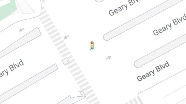
If the feature is live, when zoomed in to street-level, users will see the improvements. Among the improvements are road widths, rounded corners, and roadside vegetation accurately depicted. Crosswalks, medians, and pedestrian islands are noted, making it easier for users to tell where they need to cross the street safely.
When navigating through a park, the pathway's actual width is shown in dark green with any stairs shown in gray. Those two features are important for parents pushing children in strollers or those with mobility scooters or wheelchairs.
The new feature is rolling out as a server-side update and is reportedly coming to everyone regardless of the maps application version or beta status. It's unclear when all users will have the new update, but those with multiple accounts may see the new features on one account and not see them on the other. The more accurate navigation should make it easier for users to get correct arrival times and travel estimates.