How The Giant Concrete Arrows Across America Guided Airmail Pilots In The 1920s
By the Fall of 1920, the U.S. Post Office had successfully completed its first transcontinental delivery from New York all the way to San Francisco. But while this was certainly much faster than ground transport, coast-to-coast airmail had its own challenges. At just a few decades into aircraft design, pilots didn't yet have the technology to safely navigate at night or in inclement weather. These planes were open cockpit, primarily made of wood and required a flight suit, helmet, and a bit of luck. GPS wasn't invented yet, but all the first airmail pilots did get Hamilton company pilot watches, which include specific features designed to help navigation, though reliably flying these mail routes still proved difficult.
To combat these challenges, postal officials arranged for acetylene gas beacons installed every three miles along airmail routes. These beacons could be seen for up to 10 miles, and were also used to identify areas for emergency landings. In fact, how pilots see at night today still involves ground lighting, and the use of modern navigation instruments.
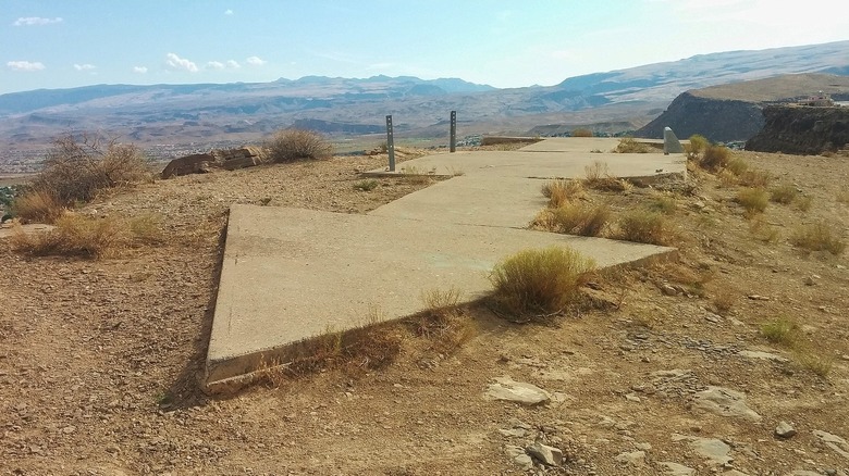
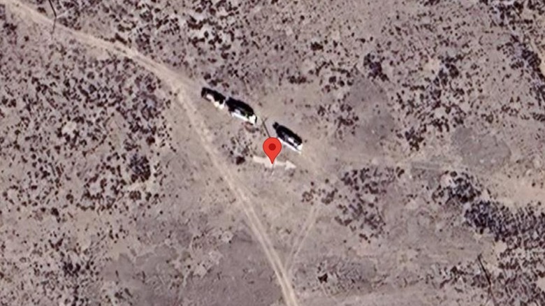
The Department of Commerce would later install massive cement arrows as long as 70 feet at each one of the beacon towers. Each tower was identified by a number, and the giant arrows were made to point to the next number in sequence. Meaning, while flying one direction the identifying numbers went up, and traveling the opposite, the numbers counted down.
The concrete arrows weren't always helpful but have become a modern fascination
The beacon towers and ground lighting did prove very useful for early airmail pilots navigating in the dark. However, the arrows and their bright yellow color were invisible during the evening, making them only potentially beneficial during daylight hours. Unfortunately, depending on the altitude, sometimes the arrows couldn't be seen by pilots among the terrain far below.
So, while this massive concrete arrow project continued until 1931, many airmail pilots had already taken to utilizing larger markers, such as bodies of water, distinctive mountain peaks and other natural formations to identify their position, when available. In some regions, no standout visual features were present to help guide pilots, and the use of a compass was required, which was one of the technologies that changed exploration forever.
However, many of these cement arrows can still be found (albeit in various forms of disrepair) throughout the country. And history buffs, eager to keep the stories of the past alive, have begun systematically cataloging these sites, and photographing them. This effort was kicked off by Brian and Charlotte Smith, who had traveled to 70 arrows by 2016. For those interested, you can see their current progress at Dream Smith Photos, which offers images, arrow and beacon locations, and old airmail routes.