This Mayan Megalopolis Discovery Changes The History Of Human Society
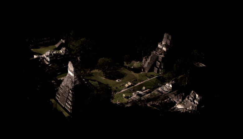
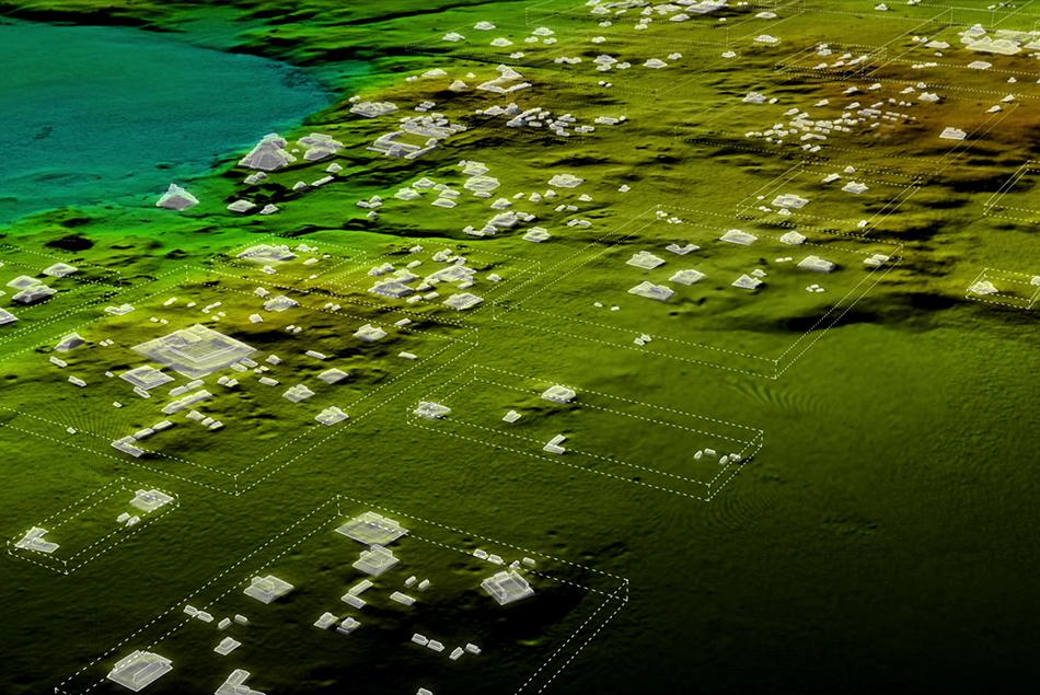
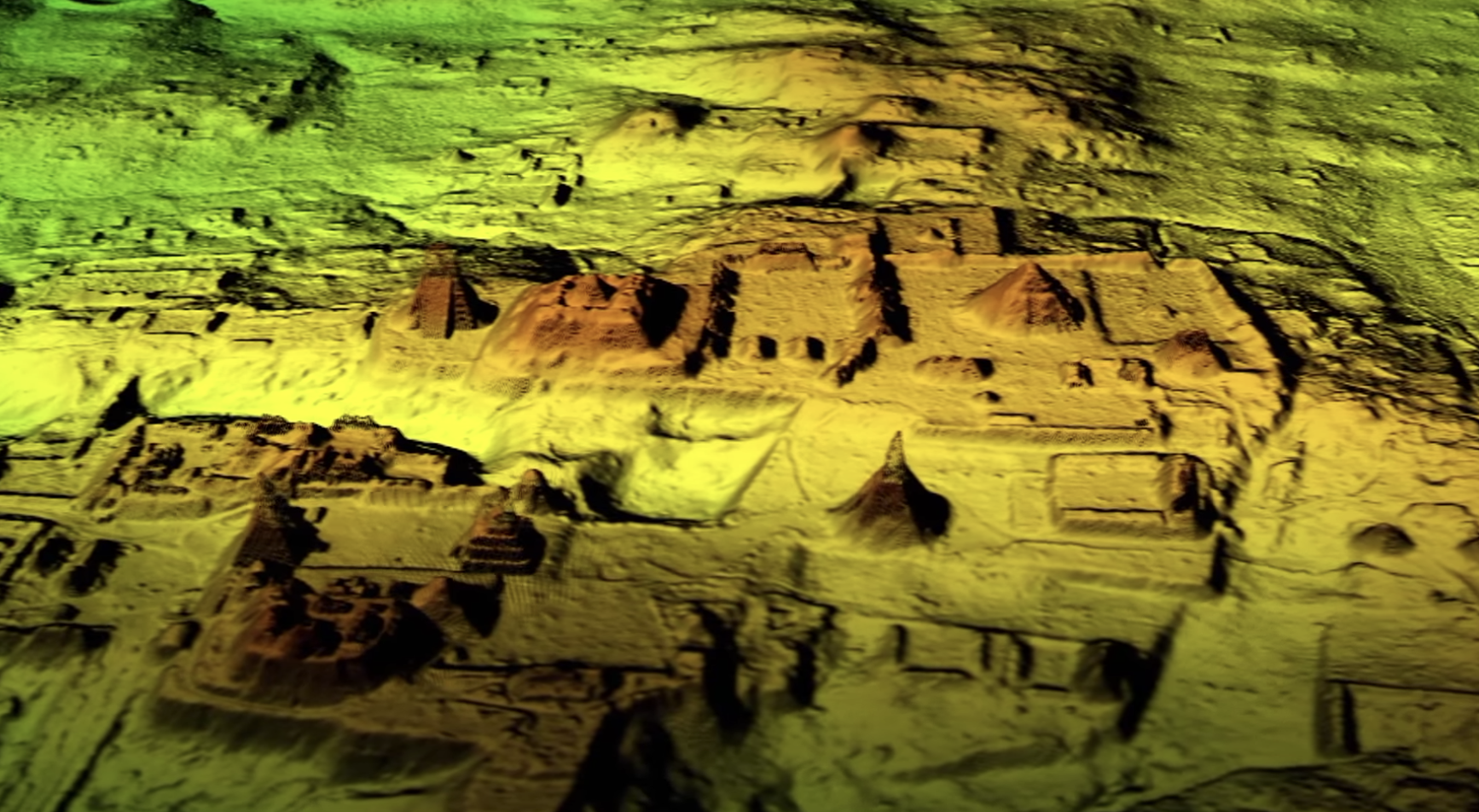
A newly massive "megalopolis" was discovered and reported for the first time this week in a Guatemalan Jungle. You can see a few old structures popping up from the trees right now, but below the surface, oh my goodness. There's one whole heck of a lot more down there than anyone in modern times knew until now. NOTE: This project not only discovered thousands of new structures, they've done so with LiDAR, so it'll all be available in 3D map file format – think augmented reality!
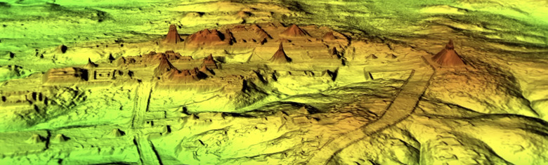
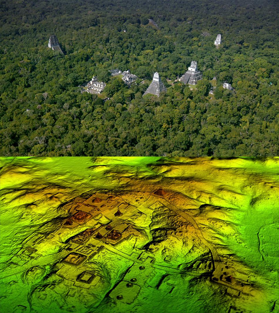
The team that discovered this newly expanded city used LiDAR to detect it. LiDAR is a tech also known as Light Detection And Ranging. LiDAR uses light from a laser to blast an area which is then 3D-mapped using the principle normally associated with radar. It hits some things and bounces back, and other things and bounces back quicker – the quicker, the closer, the slower, the further.
Millions more people lived in this massive city than previously believed. Newly discovered buildings numbering over 60,000 were uncovered – digitally, for now – the lot of which hadn't been known of or known to this extent. As National Geographic suggests, these buildings included houses (most of them were houses,) as well as elevated highways, large palaces, and other human-made structures of many sorts.
Wartime structures were discovered as well. Included amongst the structures were ramparts, fortresses, terraces, and defensive walls of several sizes. Canals, reservoirs, and dikes were dug as well, made to direct the massive amount of rainwater that still falls in Guatemalan jungles today. Everything in the area showed signs of planning for the rainy season, including elevated highways.
"We've had this western conceit that complex civilizations can't flourish in the tropics, that the tropics are where civilizations go to die," said Tulane University archaeologist and National Geographic Explorer Marcello Canuto. "But with the new LiDAR-based evidence from Central America and [Cambodia's] Angkor Wat, we now have to consider that complex societies may have formed in the tropics and made their way outward from there."
The group that made this discovery possible was a consortium of researchers headed by the PACUNAM Foundation (aka Fundación PACUNAM.) That's a Guatemalan nonprofit organization that's likely very happy with what their work has produced – massively important history-changing information the likes of which have rarely been seen in our recent history. One very big discovery indeed.
Research previously suggested that Mayans inhabited small cities, far apart and sparse. With this one discovery comes a new understanding. Here we find that these ancient Maya were a culture amongst the most developed ancient cultures in the world. "This was a civilization that was literally moving mountains," said Canuto.
So Mayan cities are bigger than researchers thought before, basically. pic.twitter.com/gyGsBLji59
— Stereo Type B (@t_chrisburns) February 2, 2018
This project suggests that the Maya classic period at its peak, between 250-900 A.D., was far, far more populous than previously assumed. "Most people had been comfortable with population estimates of around 5 million," said Estrada-Belli, a Holmul, Guatemala archeologist speaking with NatGeo, "With this new data it's no longer unreasonable to think that there were 10 to 15 million people there—including many living in low-lying, swampy areas that many of us had thought uninhabitable."
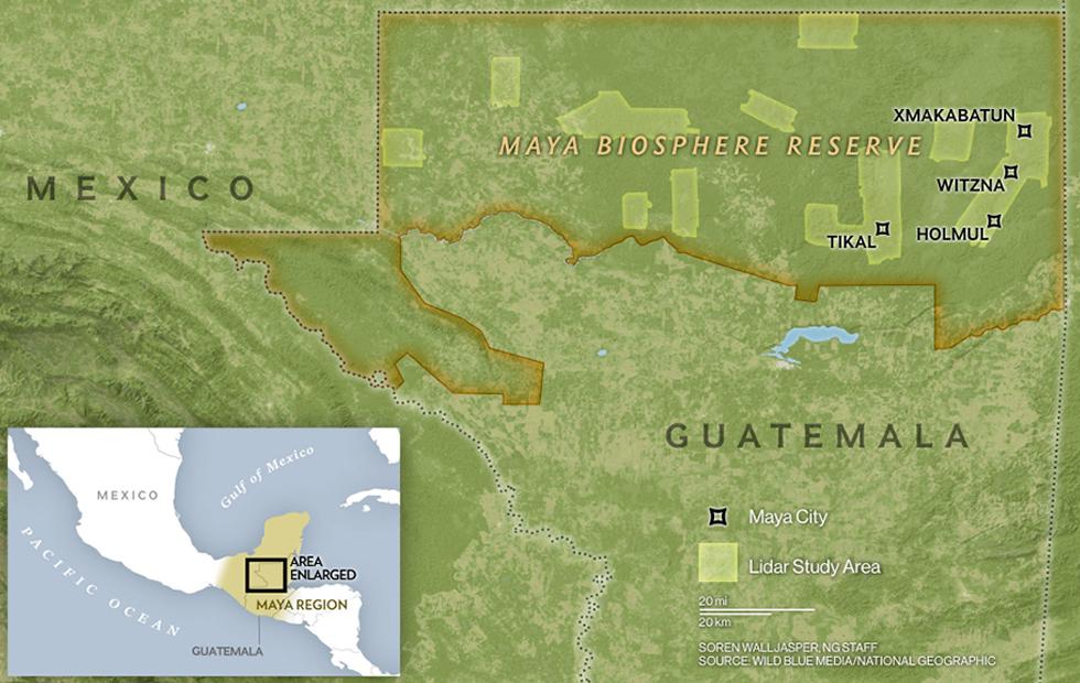
This is one part of the PACUNAM LiDAR survey, This survey took place starting in 2016 within the Maya Biosphere Reserve (MBR) of the northern Petén district of Guatemala, and covered over 1400 km2 of forested areas. In some of the areas surveyed, only "cursory archaeological research" had previously been done in modern times.
Yeah I'm gonna need those files, THX pic.twitter.com/0DQtNTkPmr
— Stereo Type B (@t_chrisburns) February 2, 2018
IN YOUR HANDS: With LiDAR, the team's mapped large portions of quite a few different areas in the MBR that they've committed to 3D files. These files can be viewed in augmented reality with a tablet (or phone, etc), on the ground, like a window into the past. Cross your fingers they'll release these files to the public sooner rather than later. Given the past releases by the NCALM LiDAR data distribution center, we'll see the files for Google Earth soon enough!
The project that's discovered all this new stuff aimed to cover large portions of the following areas in the MBR: Tikal, El Zotz, Holmul, La Corona, Xultun, San Bartolo, Waka', Naachtun, and Uaxactun. For a visual peek at what this project's team discovered, there'll be a NatGeo TV special premiering the day before Valentine's Day. The special "Maya: the Lost Treasures" will air (or has aired, depending on when you're reading this) on National Geographic as early as this February 13th – check your local listings for times and channels and whatnot.
UPDATE: Apparently this documentary is called something slightly different depending on what part of the world you're in. It'll also be called "Lost Treasures of the Maya Snake Kings" too – good luck finding it! The preview for this TV special is included just above this paragraph, just for you.