The 2 Key Parts Of NASA And ISRO's Disaster Satellite Just Came Together
It's not being called the doomsday satellite, but NASA-ISRO SAR perhaps should be, with work on what will eventually be a watchful eye over incipient natural disasters continuing ahead of its expected launch in 2022 or beyond. A collaboration between NASA and the Indian Space Research Organization (ISRO), the satellite will be the first designed to track changes in the nearly the entire surface of the Earth, which could provide a vital warning of upcoming volcanic eruptions or highlight the impact of climate change.
Certainly, volcanoes that are mid-eruption aren't hard to spot, and the same goes for flooding from ice sheet melt and rising sea levels. If you want to get a handle on when that might happen beforehand, though, it can be a far trickier challenge.
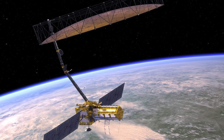
The NASA ISRO Synthetic Aperture Radar – known as NASA-ISRO SAR, or NISAR for short – will be the tool to take that challenge on. Though the body of the satellite itself is roughly akin to an SUV, once deployed in orbit around Earth it will unfurl a huge wire mesh radar reflector antenna. That will span nearly 40 feet across, suspended from NISAR on the end of a 30 foot boom arm.
With that, NISAR will bounce radar signals off the surface of the planet, using the reflections to figure out tiny changes in land, ice sheet, and sea ice. It'll be capable of some astounding detail in those measurements, too: movements as small as 0.4 inches, NASA suggests, over areas roughly half the size of a tennis court.
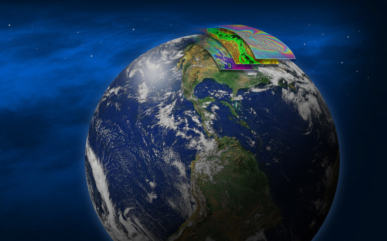
Every 12 days, NISAR is expected to scan the surface of the whole globe. With the data it collects, scientists expect to be able to spot things like magma moving – which could be a warning sign of imminent volcanic eruptions – or sinking patches that might indicate groundwater supplies are being depleted. It'll also allow melt rate of ice sheets tied to sea level rise to be tracked, and even changes in how vegetation is distributed around the world to be monitored.
That's no easy task, and NISAR will have some mighty clever hardware in order to achieve it. Currently under construction at NASA's Jet Propulsion Laboratory in Southern California, it most recently received its S-band SAR that joins the L-band SAR and gives the satellite its unique sight.
The combination of the two types of SAR will unlock far more usable data. L-band SAR, for example, can penetrate through dense vegetation much further: it'll be useful to help estimate how much of that there is in heavily forested areas. S-band SAR, in contrast, is more adept at detecting crop types, along with how rough the surface of the Earth is. In the coming weeks, the JPL team expect to integrate the electronics of both systems, as ISRO and NASA staff work together to make sure the radars work as intended.
Then will come their mounting on the NISAR satellite itself. If all goes to plan, the launch is expected to take place in 2022 at the earliest, with the primary mission scheduled to last three years.