Scientists Create Highest Resolution Antarctic Map Ever
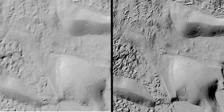
Antarctica is a very cold and desolate place and maps of the continent were not of very high resolution in the past. Previous maps had a resolution of 1,000 meters, but a new map has been created that changes that. The new high-resolution map created by a mapping project called The Reference Elevation Model of Antarctica has a resolution of 2 to 8 meters.
Professor Ian Howat from Ohio State University notes that until now scientists have had higher resolution maps of Mars than Antarctica. The new high-resolution maps make Antarctica now the best-mapped continent on the planet. The new map and images that go along with it promise to change science on the content, more so as it is updated.
The resolution is high enough that scientists can see variation in the snow in some places. This will allow the measurement of changes over time on the surface of the continent. That means monitoring thinning of glaciers, river discharge, flooding, and volcanos.
The new map will also allow scientists, researchers, and explorers to plan trips over the often-treacherous terrain of the continent. Images from a constellation of polar-orbiting satellites were used to take photos for the map. An average of ten passes of each were used to take the photos.
Researchers on the project note that they had to start from scratch to build the map. There was no software to filter the data, process it, or to turn it into a refined product. Processing of the images was performed on the Blue Waters supercomputer provided by the Polar Geospatial Center at the University of Washington and the University of Illinois.
SOURCE: REMA, Ohio State University