Ominous NASA Climate Change App Shows Which Cities Will Flood
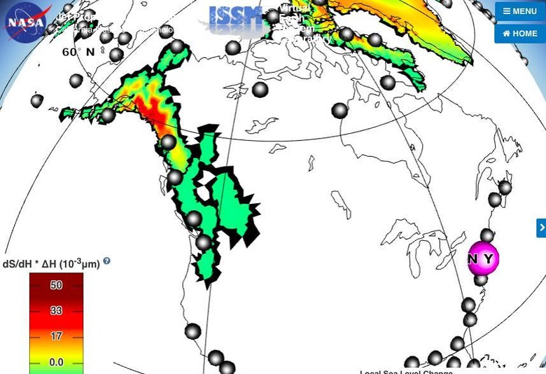
Coastal cities around the world are at risk of severe flooding and even eventual eradication as ocean levels rise. A new simulation from NASA highlights how big this potential problem is, showing what could happen to 293 coastal cities around the world over the next 100 years. Among the observed changes are severe flooding to big locations like New York City and London.
Coastal flooding is already a growing problem in some places, the result of melting ice that causes ocean levels to rise. Researchers have warned for years that rising ocean levels will cause increasingly catastrophic floods in many places around the world, and that decades from now some big regions could be left entirely underwater.

NASA's new simulation is the most recent to visualize these changes, but it takes things a step further by breaking down which cities will be effected by various sources of melting ice. For example, ice melting from the northeastern half of Greenland will most heavily affect New York City despite some other coastal cities being closer. Another example of catastrophic flooding would be the eradication of Sydney, Australia, by melting Antarctic ice.
Users are able to change various conditions in the simulation, helping cities and planners determine what changes need to be made to help mitigate potential future disasters. The simulation shows potential outcomes as far as 100 years into the future, and may be a useful way for home buyers and others to decide where to purchase property from a long-term standpoint.
A paper discussing the research (below) explains:
We exploit an advanced mathematical property of adjoint systems and determine the exact gradient of sea-level fingerprints with respect to local variations in the ice thickness of all of the world's ice drainage systems. By exhaustively mapping these fingerprint gradients, we form a new diagnosis tool, henceforth referred to as gradient fingerprint mapping (GFM), that readily allows for improved assessments of future coastal inundation or emergence.
SOURCE: Science Mag
