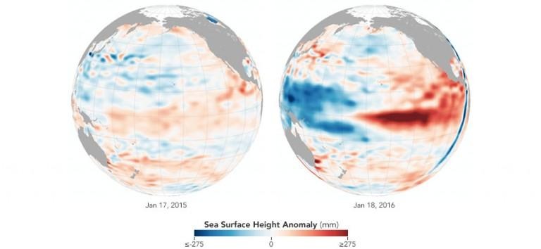
NASA: We're Probably At Peak El Niño
According to NASA's Earth Observatory, we've "probably reached the peak" of El Niño, though how the coming months will play out isn't certain. The space agency says it is possible that tropical Pacific waters will be back to neutral by this upcoming summer, or it could play out that we get a La Nina instead, which has happened in the past.
NASA doesn't sound entirely certain about the current El Niño progression, pointing toward "past events" to help shape an understanding of what's going on now. Uncertainty about how the El Niño will peter out is partly due to global warming and the higher temperatures around the globe in comparison to past decades.
This El Niño has had significant impacts on weather around the globe, including producing spring and summer-like temperatures this winter in the northeastern United States. NOAA largely agrees that we could be past the peak, with the transition toward neutral starting in late spring or so.
However, a NASA climatologist warns there could be a second peak for El Niño due in part to a west wind burst combined with slowing trade winds. The west winds could end up pushing warm waters toward us, spurring a second peak. Those in the western US, finally, are likely to still see the effects of the El Niño through March.
SOURCE: NASA
