NASA Unveils Map Of Most Accessible Water Ice On Mars
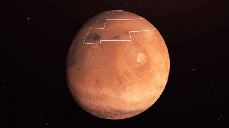
One of the biggest challenges for sending humans on missions into deep space or to another planet is in taking enough water to support human life and for fuel. This is why it's so important to find water on other planets that humans can access and use. NASA is planning to send humans to Mars in 2024, and ahead of that trip, it has unveiled a map that shows where the easiest to access water ice is on the surface of Mars.A new paper published shows a region of Mars that may be the best landing site on the Red Planet. In the area outlined by the white lines, the water ice is believed to be as little as an inch below the surface of the planet. The easily available water could be used for drinking and making rocket fuel.
The presence of easily accessible water such as this is a key consideration when choosing a landing site for the future Mars mission. Scientists for NASA say that in this location, the water ice could be dug up with a shovel. Finding ice on Mars is difficult because of the thin atmosphere; any liquid water evaporates from a solid to a gas when exposed to the atmosphere.
Scientists used a pair of instruments to search for ice, including the Mars Reconnaissance Orbiter Mars Climate Sounder and the Thermal Emission Imaging System camera on the Mars Odyssey. The use of heat-sensitive instruments works because buried water ice changes the temperature of the Martian surface.

The authors of the study cross-referenced temperatures suggestive of ice with other data like reservoirs of ice detected by radar or seen after meteor impacts. The data suggests that the best target for a landing near water is a region called Arcadia Planitia. That area has lots of blue and purple, which indicates water ice less than a foot below the surface. The black areas are those where the spacecraft would sink into a fine dust.