NASA Shares First GOES-17 Image Of Earth's Western Hemisphere
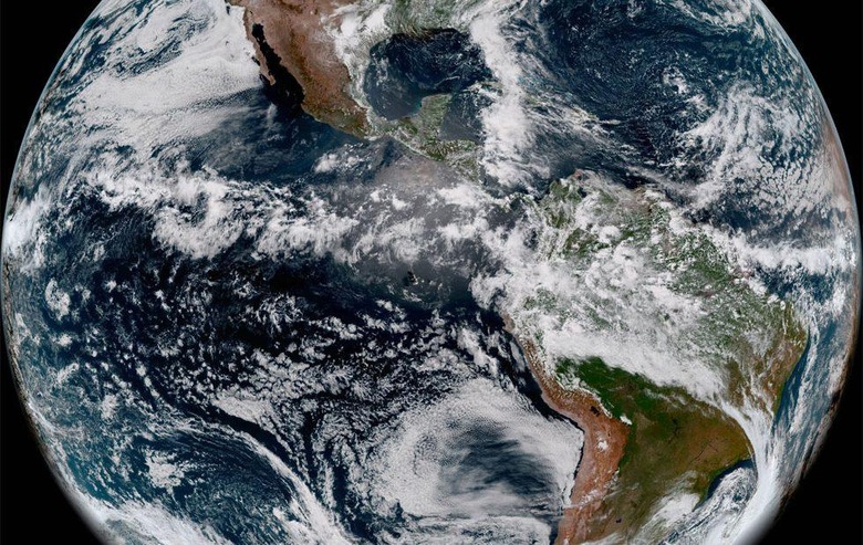
NASA has shared the first image captured by the GOES-17 spacecraft. The image was taken with the Advanced Baseline Imager (ABI) and was debuted for the first time publicly this week. The image was snapped at 12:00 p.m. EDT on May 20, 2018.
GOES-17 orbits the Earth at an equatorial vantage point 22,300 miles above the surface of the planet. Experts continue to work on an issue with the imager on the satellite that has to do with the cooling system, but the new shared image shows that the ABI is working and can take stunning pictures. The image was created using two visible bands of blue and red along with one near-infrared "vegetation" band.
These are the bands functional with the satellite facing cooling system issues. The three bands were combined as a "GeoColor" image that shows vivid detail of the planet below and colors that humans can recognize. These bands can provide information for monitoring dust, haze, smoke, clouds, fog, winds, and vegetation.
ABI images are also used by meteorologists to monitor and forecast weather and hurricanes. GOES-17 has improved resolution and faster scanning compared to the previous satellite. GOES-17 launched on March 1, 2018, from the Kennedy Space Center.
Right now, the satellite is in the post-launch checkout and testing phase where instruments and systems are calibrated, validated, and assessed for operational use. NASA has offered no guidance on the status of fixes for the cooling system at this time.
SOURCE: NOAA