MIT's Autonomous Drone Fleet Can Operate In Dense Forests Without GPS
Those who don't hike or live in an area where hikers flock don't understand how easy it can be to get lost in unfamiliar terrain, even when using maps. While it's not hard to get lost, it's very hard for rescuers to search for lost or injured hikers. The major challenge comes when hikers are lost inside a dense forest where helicopters and drones aiding in the search are unable to see what's under the trees.
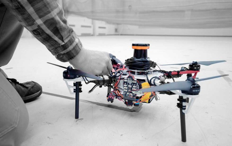
The problem with using traditional drones under the forest canopy is that drones typically require GPS and under thick tree cover, GPS signals can't reach. MIT has developed fleets of autonomous drones that can be used to search for hikers under forest canopies that need no GPS. The drones use only onboard computation and wireless communications to operate.
Each of the autonomous quadcopter drones has a laser range finder for position estimation, localization, and path planning. The drones create their own 3D map of the terrain around them and then use algorithms to recognize spots that haven't been explored and those they have been searched. This allows the drone to know when an area is fully mapped.
A ground station gathers the data from each drones' individual maps into one global map that can be viewed by human rescuers. While the MIT drones currently lack object detection, when the system is used in the real-world object detection capabilities would be integrated allowing drones to tag the location of hikers on the map.
Part of the mapping system the drones use is LIDAR that 2D scans the obstacles around the drone using laser beams. The LIDAR system can identify clusters of trees by angles and distances between the trees, helping it to determine if an area has been mapped. Currently, the drones require a wireless router nearby to send map data to the ground station, in future implementations the engineers hope have the drones communicate wirelessly when close to each other and then disconnect when they separate.
SOURCE: MIT