See Kilauea From Above: Hawaii's Volcano Situation
There's a volcano by the name of Kilauea leaking lava in Hawaii right now – did you know? Let's have a chat about what's going down. This week interest in the volcano's become especially important because of the very active nature of Kilauea's contents – and therefore the surrounding area. Thanks to the the Advanced Spaceborne Thermal Emission and Reflection Radiometer (ASTER) onboard NASA's Terra satellite, Hawaii's been given warning of the hotspots in the area surrounding the volcano. Today we get to see what the satellite's seen.
On the 30th of April, Kilauea's crater (the mouth, the scariest part of the volcano) began to collapse. Earthquakes broke loose bits of earth, and lava began to flow. Video later in this article shows that lava – filmed by professionals and very, very insane citizens of the island. Do not try this at home.
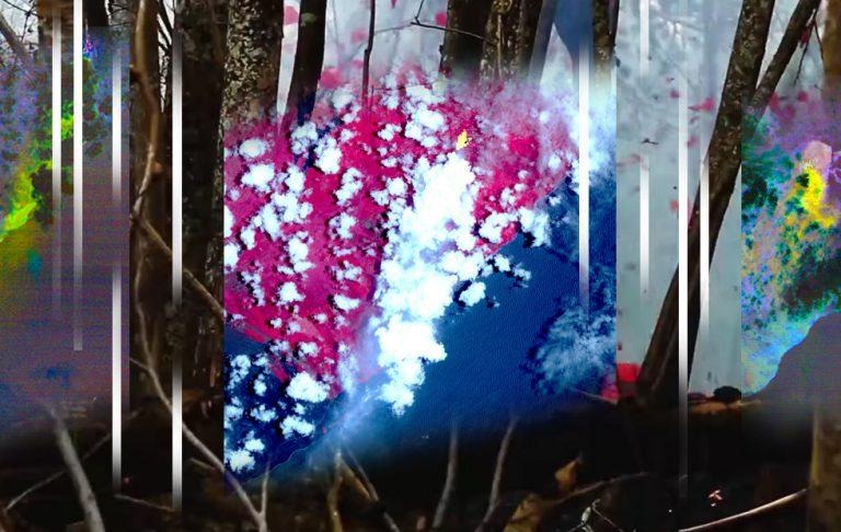
The island where this is all happening is called Hawai'i – the southernmost island in the chain of islands that make up what we know as Hawaii. Kilauea accounts for a sizable chunk of the island, covering the most southeastern and eastern parts of the island. In the image you're about to see, NASA shows Kilauea on Hawai'i marked with several colors.
• RED: Vegetation
• YELLOW: Hot Spots
• BLACK: Old lava flow
• GRAY: Old lava flow

The image above is credited to NASA/METI/AIST/Japan Space Systems, and U.S./Japan ASTER Science Team. This image was captured on May the 6th, 2018 by ASTER on Terra. The image is a photographic composite showing thermal infrared band-marked hotspots around Kilauea. The bits that you'll spot in yellow are hotspots. These are the places you'll want to avoid in the very near future.
Below you'll see another image captured in the same area by the same satellite. This image shows different thermal bands than those shown above, allowing us to see sulfur dioxide plumes of smoke. That's what the yellow and green show here – nasty, nasty sulfur dioxide, all plumin' out like nobody's business.

Next we've got some imagery from NASA's Multi-angle Imaging SpectroRadiometer (MISR) instrument, also housed by NASA's Terra satellite. This is the same satellite as mentioned above, but a different camera. The images were captured on the same day as the images shown above.

The image above shows what MISR caught, both with and without superimposed height data. The plume reaches 6,500 feet (2,000 meters) altitude. This altitude was calculated using the MISR INteractive eXplorer (MINX) software tool. You can take a closer look at the MINX tool over on Github.
Above you'll see a lovely view of "15 Vents Spouting Lava" as captured by the Associated Press. It's nice to see from afar – but I wouldn't want to be anywhere nearby, that's for certain. Next you'll see a video from Syracuse dot com. They've collected a number of video clips of the lava as it creeps (and in some cases bubbles violently) out from Kilauea.
We'll more than likely have additional photos and/or video of the area once it's progressed to more explosive levels. Have a peek at SlashGear's Science portal for more as it happens.