ISS Pictures Are Being Used To Map Global Light Pollution
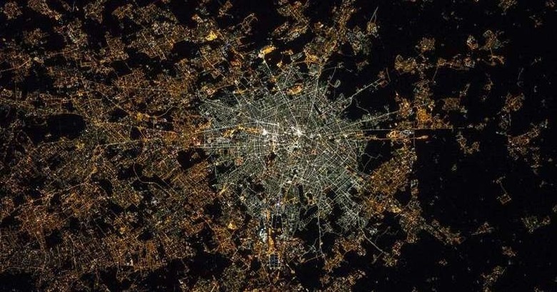
A project called Cities at Night is using photographs taken by astronauts from the International Space Station to map nightly light pollution in cities across the world. The project started last summer, and requires the mapping of more than 130,000 high-resolution photographs using geo-centric details. This project is looking at the amount of light produced by cities across the entire globe, including the smaller sources of scattered light in addition to the bigger, more obvious points of light pollution.
As anyone who lives near — but not right in — a city knows, the bright points of light inside of a city cause a glow that leaks across the night sky, being visible miles beyond the city's center. The pictures from space further confirm this, showing clearly the extent of this glow coming from lamps, buildings, and signs.
The biggest downside to light pollution for most people is the reduced visibility of the night sky — you can't lie outside and watch the stars if you're anywhere near a bright city.
A bigger issue of light pollution, though, is what it indicates — a large amount of energy being burned in big cities to produce light. The researchers have found that European cities with high debt also have higher energy use going into nighttime lighting.
The benefit of the Cities of Night project is that the resulting map can, for what is said to be the first time ever, show reliable data on light pollution across large regions. The data will help shape research on things like health, environmental effects, and more as they relate to light pollution.
SOURCE: Phys.Org