Google Search And Maps Now Show Wildfire Info, Boundaries
As if it weren't bad enough with the COVID-19 pandemic, citizens on the US West Coast, especially in California, now also have to brave the wildfires blazing across many states. Dealing with this calamity is just as unpredictable as the virus and people's best bet is getting the right information at the right time. As the company that practically has all the information available on the Internet, Google is moving fast to equip both Google Search and Google Maps with emergency information related to these wildfires that will alert users to the danger and the extent that the fires cover.
Wildfires, as their name suggests, can happen in a flash and spread quickly before anyone has time to react. From California to Colorado, people are being evacuated to save them from the fires that are ravishing thousands of acres of land. People both in affected locations and surrounding areas, however, may not know how near they are to danger until it's too late. Now all they need to do is search on their phone to find out.
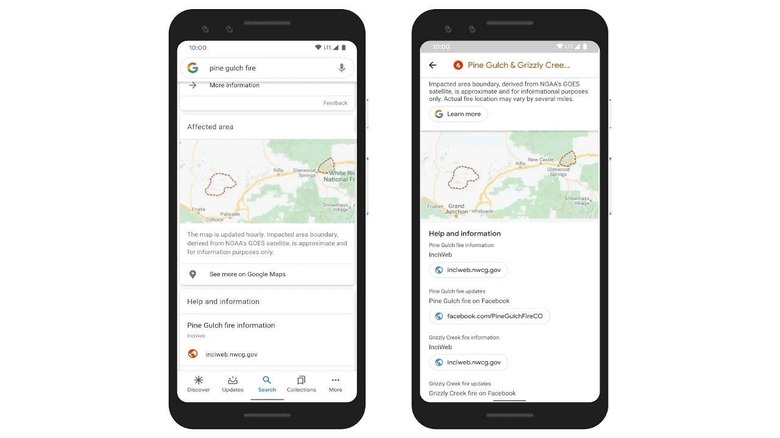
Searching with keywords like "wildfire in California" or even keying in specific places will now show users the approximate boundary of the fire, along with important news and resources like emergency numbers and agencies. The boundary information is taken from a combination of data from the National Oceanic and Atmospheric Administration's (NOAA) satellites as well as Google's own Earth Engine.
Google Maps will also show the same results but with some additional features not available when using Search only. Users approaching a blaze or exploring an area near wildfire will receive alerts on their phones.
It might be easy to downplay the importance of these features but when everything is in chaos, the availability of timely and accurate information can be a matter of life and death. And that's not just for the people directly affected by these fires but especially for those responding to calamities in order to save lives.