Google Earth creates 30-year timelapses of climate change
Google has announced a new Google Earth Timeplapse feature, created in partnership with Time, that presents satellite imagery from 32 years of the Earth's surface in animations to show in detail how our planet is changing. Google Earth has added an additional four years of maps to what was available before, and now makes use of higher-resolution images that offer greater surface details, as well as animations with consistent color and quality.
When Google originally launched its timeplapse tool back in 2013, it relied on low-grade imagery that offered a general idea of how a location looked, but was also inconsistent with quality and color, making details like roads and building almost impossible to see.
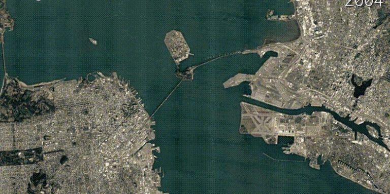
Thanks to imagery from two new satellites, timelapses are smooth and crystal clear, allowing users to see the growth and development of urban areas and infrastructure, such as the San Francisco Bay Bridge location, as well as the deterioration of natural environments and other climate changes caused by carbon emissions.
There's imagery of glaciers melting in Antarctica, the loss of coastal areas in Louisiana, and the loss of forest areas in Alberta, Canada. Users can search and view timelapses of just about anywhere on Earth on the new Google Earth Timeplapse website, or there's a huge YouTube playlist with 40 hours of footage from different locations like the videos seen here.
SOURCE Google Blog