NASA Launches Critical Mission To Learn How Solar Storms Really Affect Earth
In September, NASA announced that the threat of solar storms is reaching a new high, noting that the activities on the Sun's surface have intensified in the past decade. Solar storms can lead to some serious damage, especially to the communications system, GPS, aviation, radio channels, satellite operations, and the power grid. To tackle the rising threat from such events and keep a close watch on space weather, NASA is launching a trio of satellites aboard a SpaceX Falcon 9 rocket from the Kennedy Space Center.
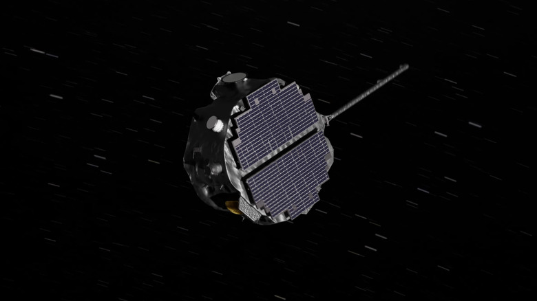
The three projects include the IMAP (Interstellar Mapping and Acceleration Probe), NASA's Carruthers Geocorona Observatory, and the National Oceanic and Atmospheric Administration's (NOAA) Space Weather Follow On-Lagrange 1 (SWFO-L1). Starting with the IMAP, the space agency notes that this system will help understand how the emissions from the Sun interact with the massive bubble around our solar system. The core objective is to understand the impact of radiation on celestial bodies (including Earth), astronauts, exploratory vehicles, and the space weather broadly.
NASA, which refers to the IMAP as a "modern-day celestial cartographer," notes that the mission will go all the way to the edge of the heliosphere. Armed with ten scientific instruments, it will predominantly focus on how the charged particles originating from the Sun are energized and how the solar winds affect the space around. Real-time analysis of these events will help scientists gauge their impact on the Earth and take necessary actions. It will do this at a distance of roughly one million miles from the Earth and will warn astronauts and spacecraft about any impending dangers roughly half an hour in advance.
Saving Earth, from a million miles away
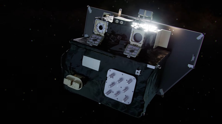
The second mission NASA is sending into space is the Carruthers Geocorona Observatory, which is going to float at roughly the same distance from our planet as the IMAP missions. The space agency claims that it will "capture the most comprehensive views of the geocorona to date." It will observe the outermost layer of Earth's atmosphere, and it's the first mission that is dedicated solely to the study of the layer's size and density, among other fundamental aspects. Also known as the exosphere, this is the nexus region that separates Earth from the vacuum of space, and a deeper understanding will help scientists predict the disturbances caused by solar activity on the planet.
NASA notes that there's a critical knowledge gap when it comes to the exosphere because only four wide-field images of the exosphere exist in the science banks. The Carruthers mission will provide high-resolution imagery of the entire exosphere continuously. Touted to be the first small satellite in history to operate from the Sun–Earth L1 Lagrange Point, its geospatial position will also help create a 3D map of the exosphere and help prepare for the impact of geomagnetic storms on Earth before they hit the communications and power grids.
Finally, we have the Space Weather Follow On – Lagrange 1 (SWFO-L1) mission, a collaboration between NASA and the National Oceanic and Atmospheric Administration (NOAA). Tasked with 24/7 observation of the solar wind activity. This is also the first observatory of its kind and will dramatically improve the weather forecasting capabilities on the ground.