This Power Outage Map Shows The Scale Of America's Storm Nightmare
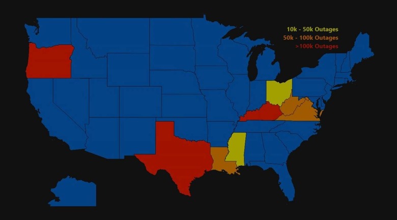
Millions of people across the United States are currently without power — and that's a big problem as temperatures drop to dangerous levels. Though Texas has primarily been hit — in terms of power outages — multiple states are currently experiencing problems, and this map makes it easy to keep track of what's happening.
The map can be found over at PowerOutage.us; it provides a general quick look at the power situation across the US, as well as more detailed breakdowns when you click on a state. If you click on Texas, for example, you can see the current power outages by county.

The page also shows which providers are experiencing outages in those regions, how many customers they're tracking, and how many are currently without power. To quickly find the particular providers and numbers you're looking for, you can click on a specific county.
PowerOutage.us aggregates data from utility companies across the US. According to the service's about page, the data is updated every 10 minutes or so, though users can check the 'last updated' timestamp for their particular county on the dedicated state page.
As of the time of publication, the states primarily affected by power outages were Texas, Oregon, Kentucky, West Virginia, and Louisiana, though Virginia, Ohio, and Mississippi also have fairly notable power outage numbers at the moment, as well.