Smoke Plume From California Wildfires Covers Over 900,000 Square Miles
Much of the state of California has been on fire for days as wildfires ravage the area destroying homes, land, and lives. Wildfires aren't uncommon in the western portion of the United States, where much of the country remains in a perpetual drought. Colorado has also had some major wildfires this year. Nothing going on in Colorado is on the scale of the fires in California.
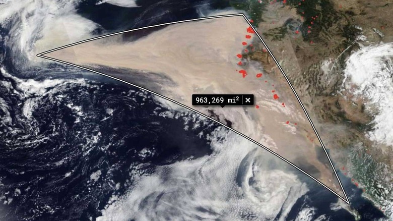
NASA's Suomi NPP satellite captured images that show the winds change in direction on September 6, 2020. Shifting winds pushed massive clouds of smoke from the California wildfires into the Pacific Ocean. By September 10, the smoke cloud had traveled over 1300 miles.
In all, the massive cloud of smoke covered 963,269 square miles. So far, 3.1 million acres have burned this year in California alone. That number represents a significant gain from the 2.5 million acres that had burned in California as of September 9. Oregon is also fighting massive fires, with 805,314 acres burned in that state. In Washington state, 500,000 acres have burned.
It seems much of the West Coast is currently on fire. High winds blowing in the West have been stoking the fires and allowed them to spread quickly. Fires consumed more than half a million acres in less than two days. So far, there have been 12 wildfire-related fatalities this year.
This has been the worst wildfire season in a long time, with the severity being blamed on the drought, excessive heat, and strong winds. Some scientists are predicting that wildfire events will continue to worsen as the climate changes. Some of the fires have burned as much as 100,000 acres in a single day.