NASA space laser mapped ice loss over the last 16 years
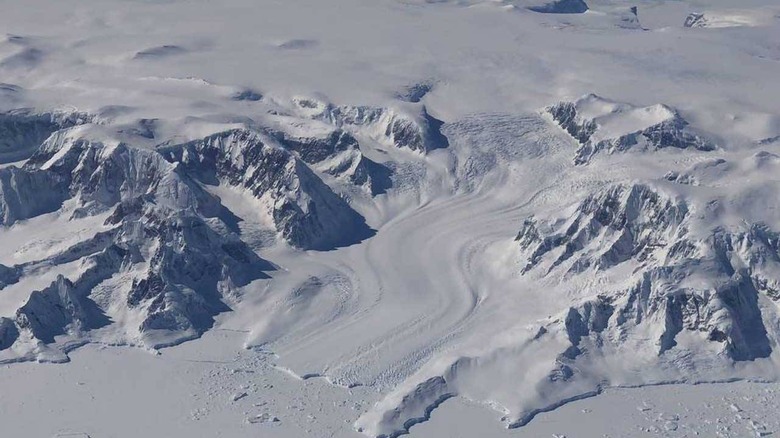
NASA has been making observations of the Antarctic and Greenland ice sheets for the last 16 years. The tool NASA has been using is the most advanced earth-observing laser instrument it's ever placed in space known as the Ice, Cloud, and land Elevation Satellite 2 (ICESat-2) launched in 2018 combined with measurements taken by the original ICESat that launched in 2003 and operated through 2009. Researchers found that the small amounts of ice gain in East Antarctica have been dwarfed by massive ice losses in West Antarctica.Scientists say that that ice loss from Antarctica along with the shrinking ice sheet in Greenland has been responsible for 0.55 inches of sea-level rise between 2003 and 2019. That is slightly less than 1/3 of the total amount of sea-level rise observed in the world's oceans. The combining of data from the two satellites have allowed researchers to generate a comprehensive portrait of the complexities of ice sheet change.
The study found that the Greenland ice sheet lost an average of 200 gigatons of ice per year, and Antarctica's ice sheet lost an average of 118 gigatons of ice per year. The scientists say that a single gigaton of ice is enough to fill 400,000 Olympic -sized pools. The instrument that ICESat-2 uses a laser altimeter that sends 10,000 pulses of light the second to the Earth's surface and times how long it takes the signal to return to the satellite within a billionth of a second.
The high pulse rate allows for a dense map of elevation over the sheet giving high precision that enables scientists to determine how much an ice sheet changes over a year to within an inch. The scientists did have to create a new model to convert volume change to mass change to allow them to calculate densities across the ice sheets and allow the total mass loss to be calculated.
The team says that while in Antarctica, the continent's interior is seeing the ice sheet thicken, losses in the margins of the continent outweighs any gains made by the interior. The team says that the ice losses at the margins of the continent are due to a warming ocean. In Greenland, coastal glaciers have lost significant ice with the Kangerlussuaq and Jakobshavn glaciers losing 14 to 20 feet of elevation per year.