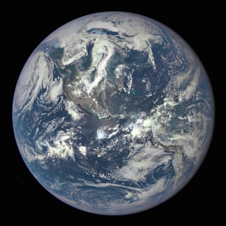
NASA releases hypnotizing new image of Earth
While much of the buzz from NASA recently has been about the New Horizons' trip to Pluto, the agency hasn't totally forgotten about the blue orb we inhabit. Captured from a camera on the Deep Space Climate Observatory, NASA has just released the satellite's first view of the sunlit side of Earth from 1 million miles away, and it sure is stunning. The image shows North and Central America, with the Caribbean islands located in the turquoise areas in the center.
NASA says the image was taken on July 6th, 2015, and the reason for the heightened tint of blue is because the effects of sunlight being scattered by air molecules can be seen. As for the turquoise areas, that's where the seas are shallower than normal.

The image even caught President Obama's attention, who shared it on Twitter, remarking that the Earth is something to be protected:
Just got this new blue marble photo from @NASA. A beautiful reminder that we need to protect the only planet we have. pic.twitter.com/JQ3174P0LF
— President Obama (@POTUS) July 20, 2015
NASA's photograph is actually a combination of three images taken by the Earth Polychromatic Imaging Camera (EPIC), a telescope and 4MP CCD camera. The camera is used to take up to 10 images, each with different filters, from ultraviolet to near infrared. The new Earth picture was created from the images taken with the red, green, and blue filters.
Once EPIC begins capturing data regularly, NASA says it will be able to provide them with daily images of the Earth, "allowing for the first time study of daily variations over the entire globe." Even better, starting in September of this year, the space agency will be posting them to a dedicated webpage within 12 to 36 hours after they are received.
SOURCE: NASA
