Google Street View goes underwater near Brazilian islands
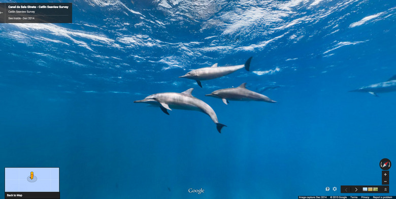
Google has slowly been imaging the world and all its nooks and crannies for Street View, and that sometime involves going to somewhat unusual or otherwise unexpected places. The Internet giant has again done this, only this time it went underwater near some of Brazil's seldom-visited and beautiful islands. There's a good change you'll never take a dive in these regions yourself, but with the new imagery you can take a plunge under the sea and get a look at, among other things, some dolphins nearby.
Google's Street View recently went to the Atol das Rocas and Fernando de Noronha islands, and it grabbed images from both on the islands and in the clear blue water around them. This was made possible, in part, with the use of a backpack featuring a 15-lens camera, as well as a partnership with Catlin Seaview Survey. This is the first time underwater images from Brazil has been added to Street View, and they're a stunning addition.
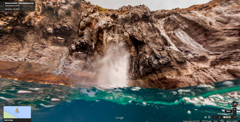
Both of the aforementioned islands are UNESCO World Heritage Sites, and visiting them isn't as easy as hopping onto a boat, given the restrictions that help with conservation efforts. In the new Street View imagery, we get a look at the Cacimba do Padre beach, the rock formations at Baia dos Porcos, and at an atoll at Atol das Rocas, which tourists are not allowed to visit, making these images all the more special.
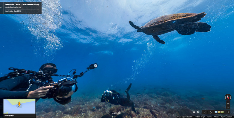
Other notable additions is the Devil's Hole at Buraco do Inferno, as well as those underwater shots where we see schools of fish, dolphins, a big sea turtle, rock formations, and more. You can check out the most notable captures from the regions here.
SOURCE: Google Maps Blog