Apple Maps street imagery vans expand to more US areas
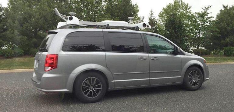
For a few years now we've heard about Apple deploying vans outfitted with camera equipment around the country to collect street-level imagery. While we'll have to continue to wait to see if this data will play a part in the company's autonomous car platform efforts, in the meantime it's surely going to use by improving Apple's own Maps service.
The latest news on the project has the mapping vehicles expanding to more areas of the US, including its first appearance in the state of Connecticut. Apple's website dedicated to the Maps vehicles has detailed the expansion, noting that Connecticut marks the 34th state they've begun collecting data in, with plans to hit areas including Fairfield County, Hartford County, New Haven County, New London County, and Windham County over the coming weeks.
Along with Connecticut, the vans are hitting the streets in parts of New York and Arizona for the first time. For New York this includes Allegany, Broome, Cayuga, Cortland, Livingston, Madison, Niagara, Orange, Putnam, Seneca, Tioga, Ulster, and Yates. In Arizona the new additions are La Paz, Maricopa, Pinal, and Yuma.
The fact that Apple's vehicles focus on collecting street-level footage suggest they might be working on their own Street View feature for Apple Maps, something that has long made Google's own mapping service the most popular option. But with how Apple's self-driving car plans have been heating up recently, including details on their autonomous vehicle platform and their test vehicles being spotted on the road, there's little doubt this mapping data is going to that project as well.
SOURCE MacRumors