NASA UAV Radar System Picked Up Signs Of Massive Louisiana Sinkhole Before It Happened
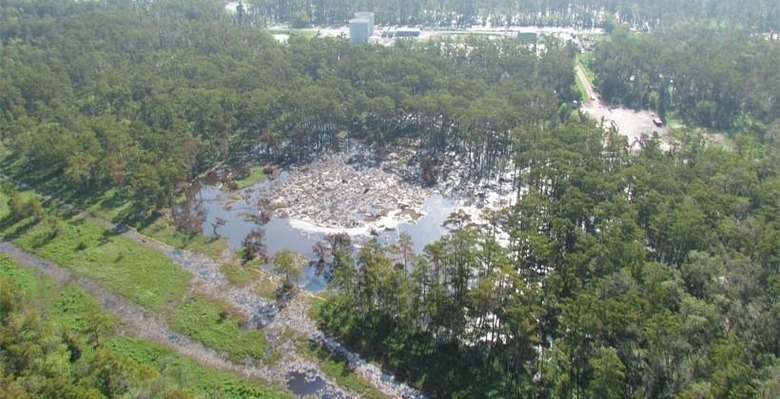
In early August of 2012, a massive sinkhole formed in Bayou Corne, Louisiana. The sinkhole was gigantic measuring 750-feet deep and spanning nearly 15 acres of land. This particular sinkhole was caused by the collapse of an underground salt dome cavern and was related to operations by a company called Texas Brine Co.NASA researchers have been analyzing data that was captures using its Uninhabited Airborne Vehicle Synthetic Aperture Radar or UAVSAR system in 2012. That NASA device used radio waves to gather information about features on the surface of the earth. Scientists at NASA looked at the ground in the area of the sinkhole before it formed.
The team scanned data that was taken from a month before the sinkhole formed and a year before it formed. The data investigation found that before the sinkhole opened up, the ground in the area had moved as much as 10-inches towards the sinkhole center. NASA researchers say that this work proves that radar remote sensing could offer a way to monitor and identify some sinkholes before they form.
NASA says that this sort of data could be particularly useful to petroleum firms working in salt domes. While the NASA radar system has proven to be able to forecast sinkholes in some areas, the chance of finding sinkholes is hit or miss. The scientists said that the UAVSAR costs a lot to operate and that users could spend lots of time processing data without discovering a sinkhole.
SOURCE: IBTimes
Image: Assumptionla.com