Mapbox shows you all the places you can't fly drones
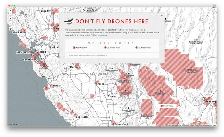
As drones and various similar flying contraptions grow in popularity, the legal contention over where they can and cannot be used is growing, and there's no sign of a simple answer coming any time soon. While the issues are ironed out, Mapbox aims to make the process a little less uncertain, creating a map that shows no-fly zones.
The idea is that while the FAA works towards establishing regulations and limitations regarding drone usage, those who elect to use the devices can take steps to avoid potential legal troubles. Using Mapbox, a user can search the area to get a look at any nearby regions that are off-limits.
The data used is open and represented by red areas on the map, and though the information is far from complete, it currently shows no-fly zones around national parks, military bases, and the space around most airports.
Of course, other areas where you plan to use a drone might be restricted but not on the map, so you should check through other resources before flying. If you do find a no-fly location that isn't currently listed on Mapbox, you can submit the information to the project.
There is a public Github repository that anyone interested can add to, something that could result in a more substantial and detailed map of areas that should be avoided. For other related news, hit up our Drones tag portal.
SOURCE: Wired