Google Street View Goes Diving With Underwater Panoramas
Google Maps has extended Street View into even more unusual places, adding underwater panoramic images courtesy of a collaboration with The Catlin Seaview Survey. The new under the sea shots include not only incredible marine topology, such as the Great Barrier Reef and Apo Island, but a wealth of sealife too (none of which has been blurred out for privacy, unlike hapless humans who accidentally get caught in Google's more pedestrian Street View system).
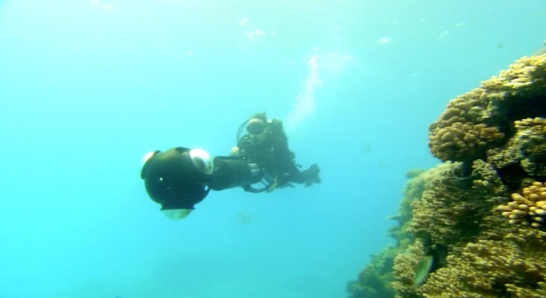
The photos were taken using a special camera tailored to underwater use, the Seaview SVII. It shoots 360-degree panoramic images instantaneously, firing off one every three seconds while moving at around 2.5mph, and each with geo-location and camera direction appended so that the data can be accurately plotted on a map.
The SVII is the second-generation of the camera, and – unlike its more finicky predecessor – is entirely controlled by a tablet. Catlin says that makes it incredibly easy to use, as well as cutting out time-consuming tasks like opening and resealing the waterproofed housing to change settings or offload images. The company intends to launch the camera commercially, though currently only two examples exist.
So far, six locations have been photographed and shared on Google Maps, in Australia, the Philippines, and Hawaii. You can find all of the underwater panorama images at maps.google.com/ocean.