Google Maps gets 250k mile Street View update
Google Maps has been updated with what's described as the "biggest ever" increase in Street View photography, with more than 250,000 miles of road around the world gaining street-level imagery. Street View coverage has been boosted in eleven countries, while new "special collections" of photography – giving more insight into particular landmarks – have been added to over six new locations.
The new sidewalk-level images have been added to roads in the US, the UK, Macau, Singapore, Sweden, Thailand, Taiwan, Italy, Denmark, Norway and Canada. Meanwhile, there are special collections in South Africa, Japan, Spain, France, Brazil and Mexico, among other locations, for instance the Ferapontov monastery in Russia and the Chiang Kai-shek Memorial Hall in Taiwan.
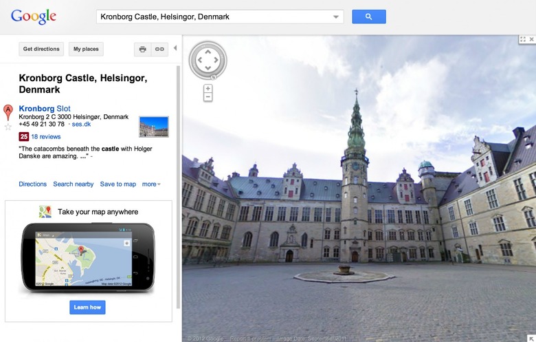
Google has also sent its cameras inside some landmarks, so you can now step into Kronborg castle in Denmark, for instance. The search giant uses a combination of Street View photography cars, bikes, and even individually-work camera backpacks to gather its footage.
Support for viewing Street View on mobile devices has been contentious in recent weeks, with Apple's decision to oust Google Maps from iOS 6 and replace it with its own Apple Maps app meaning iPhone 5 and other iOS device users lost the ability to see street-level images. Google re-added access by updating its webapp, however, and has promised a native version of Google Maps for iOS by the end of the year.