Google Earth satellite images may have discovered new Egyptian pyramids
People who study Google Satellite images have found curious objects in the images on more than one occasion. People have thought satellite images showed Atlantis, and we've seen images in the past that looked to be some sort of giant grid on the ground. A new batch of Google Earth satellite images have unveiled what some are saying are lost Egyptian pyramids.
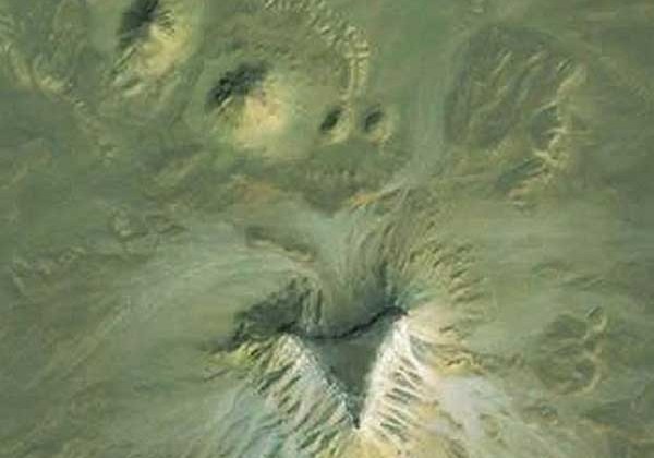
What is believed to be two separate pyramid complexes may have been discovered using satellite imagery. The complexes are located about 90 miles apart. The satellite images show unusual groupings of mounds that have unusual features and orientations. The features were discovered by a satellite archaeological researcher named Angela Micol from Maiden, NC.
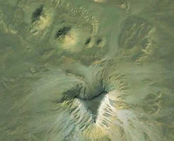
One of the sites is in upper Egypt 12 miles from the city of Abu Sidhum along the Nile River. This site has four different mounds each with a larger triangular-shaped plateau. At this particular site, the two larger amounts are roughly 250 feet wide with a pair of smaller mounds measuring roughly 100 feet in width. The entire complex is arranged in a clear formation with the large mound extending the width of 620 feet, nearly 3 times the size of the Great Pyramid.
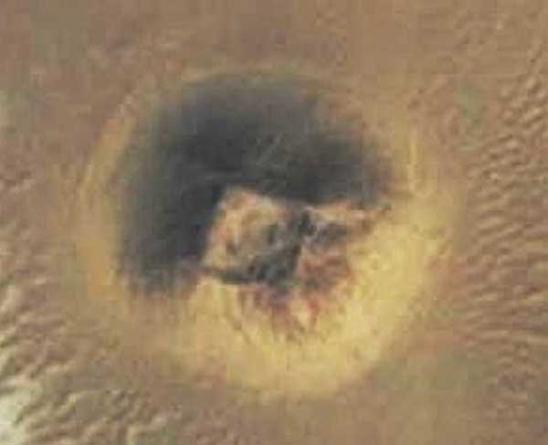
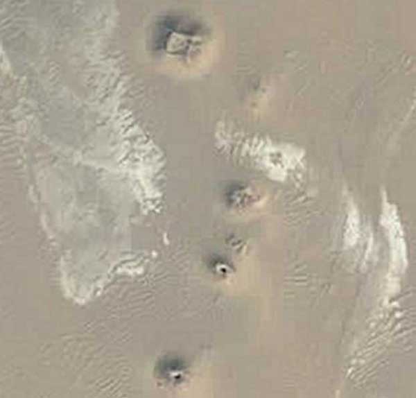
90 miles north of the first site near the Fayoum oasis is the second pyramid complex believed to contain a four sided truncated mound approximately 150 feet wide. This particular site has a distinct square center, which is unusual for a mound of the size. 1.5 miles southeast of an ancient town called Dimai three smaller mounds were discovered in a very clear formation similar to the diagonal alignment of the Giza Plateau pyramids. Micol says that both sites discovered using Google Earth images have been verified as undiscovered by Egyptologist and pyramid expert Nabil Selim. The next step after the discovery using satellite images will be field research.
[via Discovery]