Google brings live transit data to New York and Salt Lake City
Public transportation carries millions upon millions of people to and from their destinations every day, so it makes sense that Google is wanting to bump up its public transit options in Google Maps in order to cater to more users. Case in point: the company just released live transit information for New York City and Salt Lake City, while adding service alerts in Washington DC.
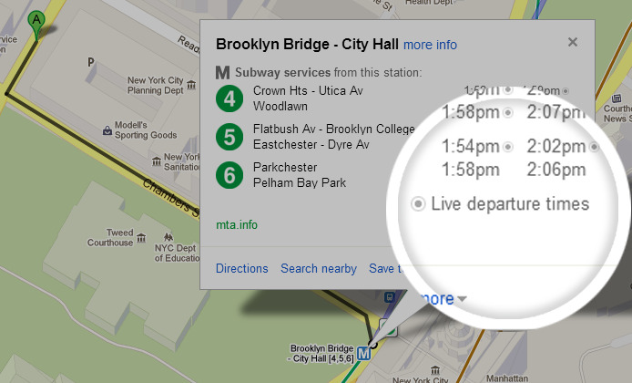
Public transit users will be able to check live departure times for seven subway lines in New York City, as well as buses and trams in Salt Lake City in the state of Utah. In Washington DC, Metro riders will now be able to receive service alerts that include delays, construction work, and any other situations that could make you late for your day job.
Google has been making strides with its mass transit features lately, while Apple's own map solution doesn't seem to be wanting to go anywhere when it comes to public transportation (yet). In any case, Google says that mass transit information is available in approximately 800 cities around the world now, including in more than 25 countries.
Google says their mass transit coverage covers around 100 million miles of public transit trips every day — that's certainly a lot of subways, busses, and trams to keep track of. With New York City having the busiest subway system in the US, it's actually about time that Google brought its live transit feature to the Big Apple.