Game of Thrones concept map shows transit system in Westeros
Game of Thrones' Westeros is a lot things, but home to a subway system isn't one of them. That didn't stop one artist from envisioning what the transportation system in the fictional world might look like, however, and we can all get a look at what he has in mind with his concept designs.
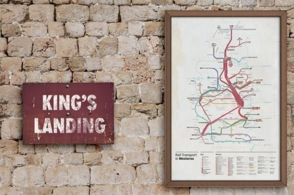
The concept designs were made by graphic designer Michael Tyznik, who made a pretty complex transit map showing how the characters in Game of Thrones could get around, should the world ever get a technological upgrade.
There are several different lines represented on the map, with the large red band in the middle taking fantasy goers from Blacktown all the way north to Castle Black, and other systems spanning all the locations to which you might want to travel.
The maps are complete with a key and list of routes, all color-coordinated. If you find the maps to be a suitable complement to your GoT's collection, the artist is selling prints on InPrnt, in sizes up to 24 x 36-inches.
VIA: BGR